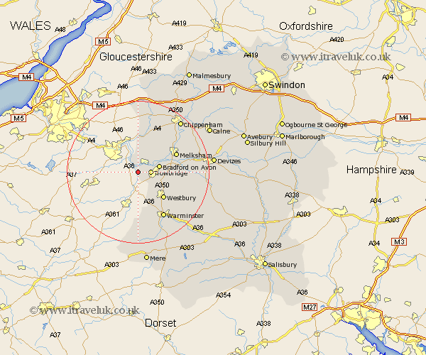
Wiltshire Map Showing Location of Westwood
Population: 1163
District: West Wiltshire
Easting: 380256 Northing: 157604
Latitude: 51.32 Longitude: -2.28
 = Westwood
District: West Wiltshire
Easting: 380256 Northing: 157604
Latitude: 51.32 Longitude: -2.28
= Westwood
This Westwood map below is supplied by Google. Use the tools in the top left corner to zoom into street level or zoom out for a road map, you may also need to zoom in to see Westwood on the map. Click and drag the map to move around. If the map fails to load try and refresh your browser or zoom in or out (+ or -).
Update - it seems Google no longer allow people to use their maps for free! This Westwood map sometimes loads and sometimes gives a error. I am working on a solution.
Closest 30 Towns or Cities to Westwood (Population over 500)
Trowbridge 3.47km Limpley Stoke 3.93km Southwick 5.09km North Bradley 5.94km Bradford-on-Avon 6.08km Bradford on Avon 6.08km Holt 6.87km Hilperton 6.95km Broughton Gifford 8.9km Whitley 9.35km Atworth 9.4km Semington 9.97km Westbury 10.17km Steeple Ashton 10.59km Dilton 10.94km Box 11.36km Corsley 11.36km Melksham 11.81km Bratton 12.85km Colerne 13.02km Edington 13.91km Seend 14.38km Warminster 14.72km Laycock 14.82km Lacock 14.82km Worton 15.06km Corsham 15.29km Erlestoke 15.51km Longbridge Deverill 17.66km Rowde 17.76km