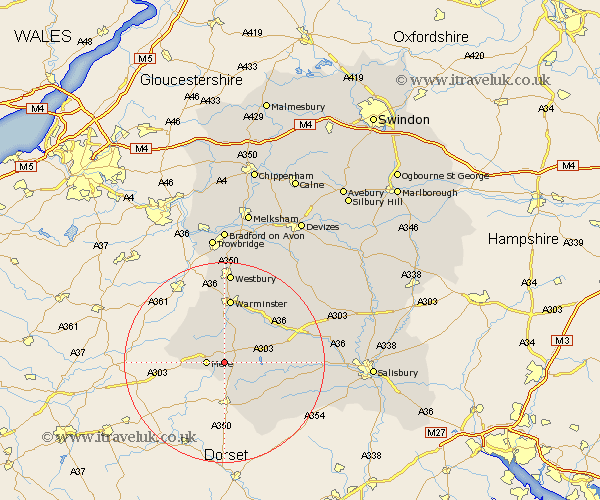
Wiltshire Map Showing Location of West Knoyle
Population: 159
District: Salisbury
Easting: 385992 Northing: 131631
Latitude: 51.08 Longitude: -2.2
 = West Knoyle
District: Salisbury
Easting: 385992 Northing: 131631
Latitude: 51.08 Longitude: -2.2
= West Knoyle
This West Knoyle map below is supplied by Google. Use the tools in the top left corner to zoom into street level or zoom out for a road map, you may also need to zoom in to see West Knoyle on the map. Click and drag the map to move around. If the map fails to load try and refresh your browser or zoom in or out (+ or -).
Update - it seems Google no longer allow people to use their maps for free! This West Knoyle map sometimes loads and sometimes gives a error. I am working on a solution.
Closest 30 Towns or Cities to West Knoyle (Population over 500)
East Knoyle 2.97km Bishop's Knoyle 2.97km Mere 3.49km Hindon 5.01km Semley 6.57km Zeal 8.36km Zeals 8.36km Tisbury 8.36km Longbridge Deverill 9.27km Heytesbury 12.55km Codford 12.83km Warminster 13.03km Fovant 14.46km Dinton 15.13km Corsley 15.24km Dilton 16.68km Westbury 18.57km Steeple Langford 19.43km Longford 19.43km Broad Chalke 20.06km Bratton 21.2km Edington 21.55km Bishopstone 22.24km North Bradley 22.27km Southwick 22.36km West Lavington 23.2km Wilton 23.28km South Newton 23.35km Shrewton 23.7km Erlestoke 24.1km