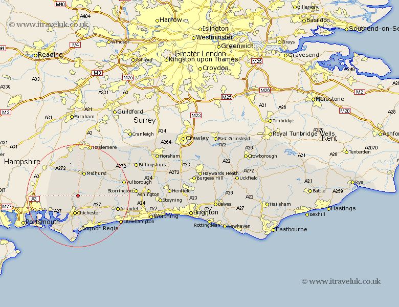
Sussex Map Showing Location of West Dean
Population: 425
District: Chichester
Easting: 486718 Northing: 111955
Latitude: 50.9 Longitude: -0.77
 = West Dean
District: Chichester
Easting: 486718 Northing: 111955
Latitude: 50.9 Longitude: -0.77
= West Dean
This West Dean map below is supplied by Google. Use the tools in the top left corner to zoom into street level or zoom out for a road map, you may also need to zoom in to see West Dean on the map. Click and drag the map to move around. If the map fails to load try and refresh your browser or zoom in or out (+ or -).
Update - it seems Google no longer allow people to use their maps for free! This West Dean map sometimes loads and sometimes gives a error. I am working on a solution.
Closest 30 Towns or Cities to West Dean (Population over 500)
Lavant 5.68km Stoughton 6.13km Tangmere 6.57km Boxgrove 6.57km Graffham 6.92km Chichester 7.51km Fishbourne 7.78km Oving 8.21km Funtington 8.98km Iping 9.34km Midhurst 9.56km East Harting 10.2km Slindon 10.88km Eastergate 11.05km Dunnington 11.18km Donnington 11.18km North Mundham 11.18km Mundham 11.18km Bosham 11.62km Southbourne 11.9km Westbourne 11.9km Walberton 11.9km Rogate 12.06km Westergate 12.88km Sidlesham 13.03km Barnham 13.17km Birdham 13.8km Tillington 14.01km Bury 14.03km Bersted 14.24km