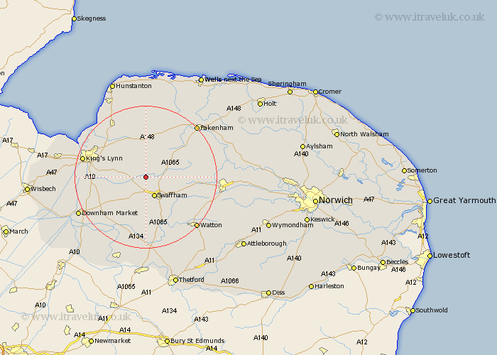
Norfolk Map Showing Location of West Acre
Population: 187
District: King's Lynn and West Norfolk
Easting: 577912 Northing: 314660
Latitude: 52.7 Longitude: 0.63
 = West Acre
District: King's Lynn and West Norfolk
Easting: 577912 Northing: 314660
Latitude: 52.7 Longitude: 0.63
= West Acre
This West Acre map below is supplied by Google. Use the tools in the top left corner to zoom into street level or zoom out for a road map, you may also need to zoom in to see West Acre on the map. Click and drag the map to move around. If the map fails to load try and refresh your browser or zoom in or out (+ or -).
Update - it seems Google no longer allow people to use their maps for free! This West Acre map sometimes loads and sometimes gives a error. I am working on a solution.
Closest 30 Towns or Cities to West Acre (Population over 500)
Castle Acre 3.37km Narborough 3.85km Swaffham 6km Gayton 6.72km Palgrave 7.69km Great Palgrave 7.69km Massingham 7.75km Great Massingham 7.75km Marham 7.9km Grimston 9.3km East Winch 9.71km Middleton 11.38km Litcham 11.38km Necton 11.54km Shouldham 11.54km North Runcton 13.48km East Rudham 14.14km Mileham 15.06km South Wootton 15.37km Ashill 15.81km Tattersett 16.28km Tatterset 16.28km North Wootton 16.34km Wereham 16.46km Great Bircham 16.68km Bircham 16.68km Runcton 16.68km Runcton Holme 16.68km Stoke Ferry 16.78km Northwold 16.83km