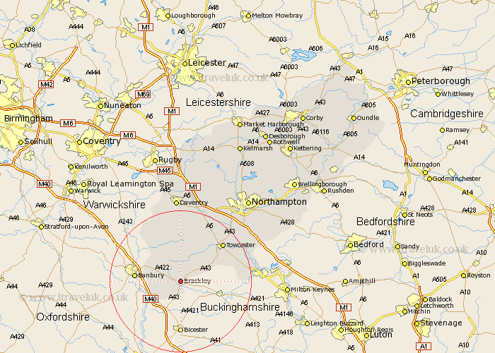
Northamptonshire Map Showing Location of Brackley
Population: 9085
Area Size (ha): 249
District: South Northamptonshire
Easting: 458303 Northing: 237598
Latitude: 52.03 Longitude: -1.15
 = Brackley
Area Size (ha): 249
District: South Northamptonshire
Easting: 458303 Northing: 237598
Latitude: 52.03 Longitude: -1.15
= Brackley
This Brackley map below is supplied by Google. Use the tools in the top left corner to zoom into street level or zoom out for a road map, you may also need to zoom in to see Brackley on the map. Click and drag the map to move around. If the map fails to load try and refresh your browser or zoom in or out (+ or -).
Update - it seems Google no longer allow people to use their maps for free! This Brackley map sometimes loads and sometimes gives a error. I am working on a solution.
Closest 30 Towns or Cities to Brackley (Population over 500)
Greatworth 4.36km Helmdon 5.68km Syresham 5.88km Croughton 6.53km Kings Sutton 8.19km Aynho 8.82km Silverstone 10.68km Chalcombe 10.68km Chacombe 10.68km Chipping Warden 12.23km Whittlebury 12.68km Paulerspury 15.82km Byfield 15.89km Towcester 15.92km Pattishall 17.41km Boddington 17.41km Upper Boddington 17.41km Potterspury 18.61km Gayton 19.41km Badby 20.52km Denshanger 20.6km Deanshanger 20.6km Bugbrooke 20.65km Blisworth 20.95km Weedon 21.17km Weedon Beck 21.17km Roade 22.37km Milton 23.07km Flore 23.27km Hartwell 23.32km