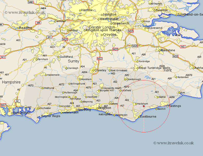
Sussex Map Showing Location of Wartling
Population: 353
District: Wealden
Easting: 565404 Northing: 108302
Latitude: 50.85 Longitude: 0.35
 = Wartling
District: Wealden
Easting: 565404 Northing: 108302
Latitude: 50.85 Longitude: 0.35
= Wartling
This Wartling map below is supplied by Google. Use the tools in the top left corner to zoom into street level or zoom out for a road map, you may also need to zoom in to see Wartling on the map. Click and drag the map to move around. If the map fails to load try and refresh your browser or zoom in or out (+ or -).
Update - it seems Google no longer allow people to use their maps for free! This Wartling map sometimes loads and sometimes gives a error. I am working on a solution.
Closest 30 Towns or Cities to Wartling (Population over 500)
Hurstmonceux 3.88km Hurstmonceaux 3.88km Herstmonceux 3.88km Ninfield 5.03km Pevensey 5.56km Pevensey Bay 5.68km Hailsham 6.14km Hellingly 7.26km Catsfield 7.94km Eastbourne 9.56km Bexhill 9.68km Polegate 9.9km Horam 10.21km Horeham 10.21km Warbleton 10.38km Crowhurst 10.69km Jevington 11.95km Mountfield 12.36km Heathfield 12.56km Battle 12.87km Chiddingly 12.95km Chalvington 14.04km Sedlescombe 14.85km East Hoathly 14.85km Alfriston 15.11km Friston 15.32km Laughton 15.65km Westfield 16.19km Burwash 16.84km Robertsbridge 16.93km