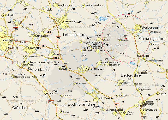
Northamptonshire Map Showing Location of Warmington
Population: 874
District: East Northamptonshire
Easting: 508598 Northing: 290365
Latitude: 52.5 Longitude: -0.4
 = Warmington
District: East Northamptonshire
Easting: 508598 Northing: 290365
Latitude: 52.5 Longitude: -0.4
= Warmington
This Warmington map below is supplied by Google. Use the tools in the top left corner to zoom into street level or zoom out for a road map, you may also need to zoom in to see Warmington on the map. Click and drag the map to move around. If the map fails to load try and refresh your browser or zoom in or out (+ or -).
Update - it seems Google no longer allow people to use their maps for free! This Warmington map sometimes loads and sometimes gives a error. I am working on a solution.
Closest 30 Towns or Cities to Warmington (Population over 500)
Oundle 4.88km Nassington 5.67km Kings Cliffe 10.04km King's Cliffe 10.04km Titchmarsh 12.47km Thrapston 14.33km Brigstock 14.64km Islip 15.81km Weldon 15.91km Stanion 17.33km Corby 18.15km Gretton 18.42km Woodford 18.64km Ringstead 19.54km Geddington 20.58km Raunds 20.62km Caldecott 21.51km Stanwick 22.78km Cottingham 23.77km Kettering 24.17km Finedon 24.37km Irthlingborough 24.48km Burton Latimer 24.6km Higham Ferrers 25.48km Isham 26.31km Rushden 27.12km Wilbarston 27.14km Rothwell 28.64km Rowell 28.64km Broughton 28.94km