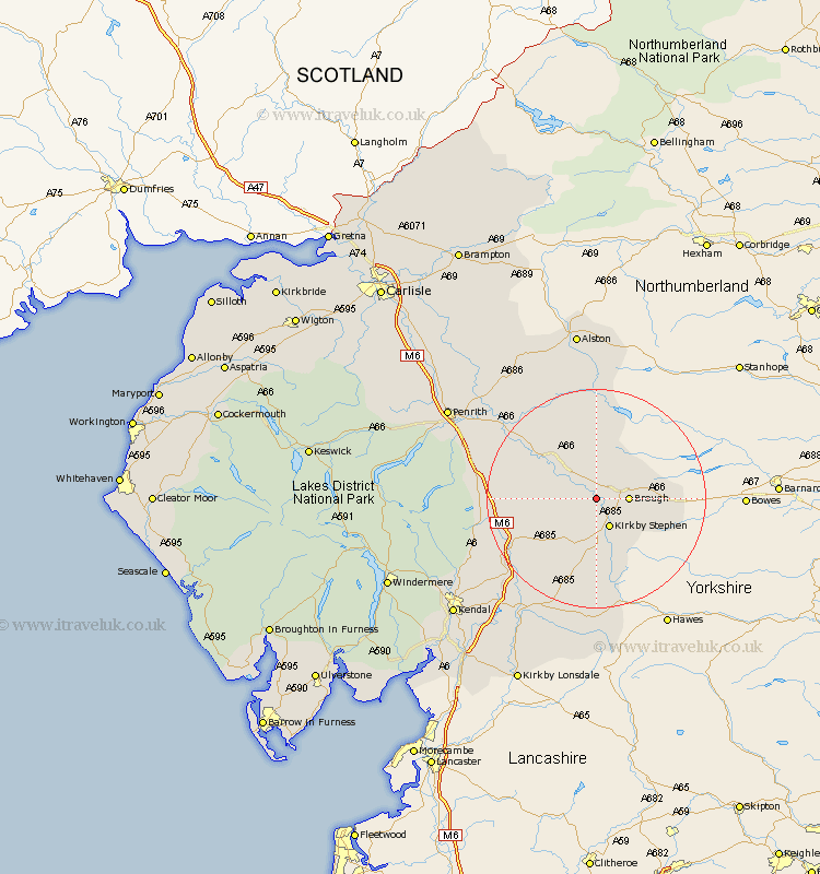
Cumbria Map Showing Location of Warcop
Population: 491
District: Eden
Easting: 375187 Northing: 513570
Latitude: 54.52 Longitude: -2.38
 = Warcop
District: Eden
Easting: 375187 Northing: 513570
Latitude: 54.52 Longitude: -2.38
= Warcop
This Warcop map below is supplied by Google. Use the tools in the top left corner to zoom into street level or zoom out for a road map, you may also need to zoom in to see Warcop on the map. Click and drag the map to move around. If the map fails to load try and refresh your browser or zoom in or out (+ or -).
Update - it seems Google no longer allow people to use their maps for free! This Warcop map sometimes loads and sometimes gives a error. I am working on a solution.
Closest 30 Towns or Cities to Warcop (Population over 500)
Brough 5.38km Kirkby Stephen 5.96km Appleby 8.51km Ravenstonedale 11.33km Long Marston 12.64km Long Marton 12.64km Crosby Ravensworth 12.91km Orton 13.08km Kirkby Thore 15.46km Tebay 17.05km Shap 18.29km Culgaith 20.36km Millthrop 23.85km Sedbergh 23.85km Milnthorpe 23.85km Langwathby 26.01km Dent 28.13km Dacre 31.07km Lazonby 31.55km Lasonby 31.55km Kendall 32.52km Kendal 32.52km Staveley 32.61km Natland 34.45km Kirkoswald 34.47km Greystoke 34.49km Skelton 37.21km Kirkby Londsdale 37.52km Kirkby Lonsdale 37.52km Windermere 38.31km