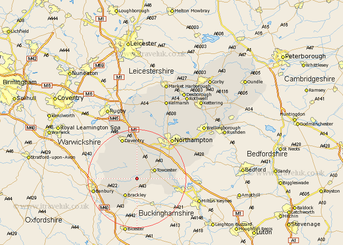
Northamptonshire Map Showing Location of Wappenham
Population: 266
District: South Northamptonshire
Easting: 462782 Northing: 245071
Latitude: 52.1 Longitude: -1.08
 = Wappenham
District: South Northamptonshire
Easting: 462782 Northing: 245071
Latitude: 52.1 Longitude: -1.08
= Wappenham
This Wappenham map below is supplied by Google. Use the tools in the top left corner to zoom into street level or zoom out for a road map, you may also need to zoom in to see Wappenham on the map. Click and drag the map to move around. If the map fails to load try and refresh your browser or zoom in or out (+ or -).
Update - it seems Google no longer allow people to use their maps for free! This Wappenham map sometimes loads and sometimes gives a error. I am working on a solution.
Closest 30 Towns or Cities to Wappenham (Population over 500)
Syresham 3.7km Helmdon 3.89km Silverstone 4.92km Whittlebury 7.08km Towcester 7.77km Greatworth 7.77km Pattishall 8.7km Brackley 8.7km Paulerspury 10.42km Gayton 10.88km Bugbrooke 12.01km Byfield 12.64km Blisworth 12.64km Chipping Warden 12.66km Weedon Beck 13.03km Weedon 13.03km Chacombe 13.79km Chalcombe 13.79km Potterspury 14.16km Badby 14.66km Milton 14.67km Roade 14.74km Flore 15km Kislingbury 15.22km Croughton 15.23km Boddington 15.54km Upper Boddington 15.54km Collingtree 15.57km Kings Sutton 15.59km Harpole 16.32km