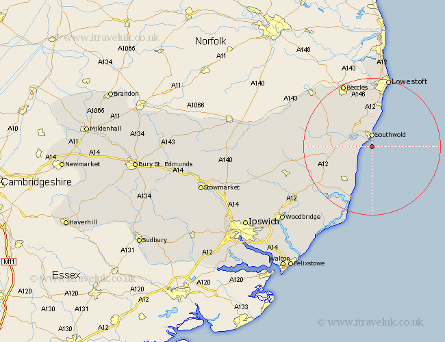
Suffolk Map Showing Location of Walberdeswik
Population: 420
District: Suffolk Coastal
Easting: 651101 Northing: 273308
Latitude: 52.3 Longitude: 1.68
 = Walberdeswik
District: Suffolk Coastal
Easting: 651101 Northing: 273308
Latitude: 52.3 Longitude: 1.68
= Walberdeswik
This Walberdeswik map below is supplied by Google. Use the tools in the top left corner to zoom into street level or zoom out for a road map, you may also need to zoom in to see Walberdeswik on the map. Click and drag the map to move around. If the map fails to load try and refresh your browser or zoom in or out (+ or -).
Update - it seems Google no longer allow people to use their maps for free! This Walberdeswik map sometimes loads and sometimes gives a error. I am working on a solution.
Closest 30 Towns or Cities to Walberdeswik (Population over 500)
Southwold 3.7km Reydon 5.67km Wangford 7.17km Wenhaston 9.25km Wrentham 9.26km Holton 11.92km Yoxford 11.93km Kessingland 13.17km Halesworth 13.64km Leiston 13.66km Gisleham 14.99km Thorpe 15.5km Thorpeness 15.5km Saxmundham 15.54km Cookley 15.97km Carlton Colville 16.72km Aldeburgh 17.62km Snape 18.01km Worlingham 18.01km Beccles 20.16km Oulton 20.66km Lowestoft 20.88km Laxfield 21.53km Bungay 23km Tunstall 24.42km Corton 24.75km Framlingham 25.56km Orford 26.18km Dennington 26.34km Fressingfield 26.64km