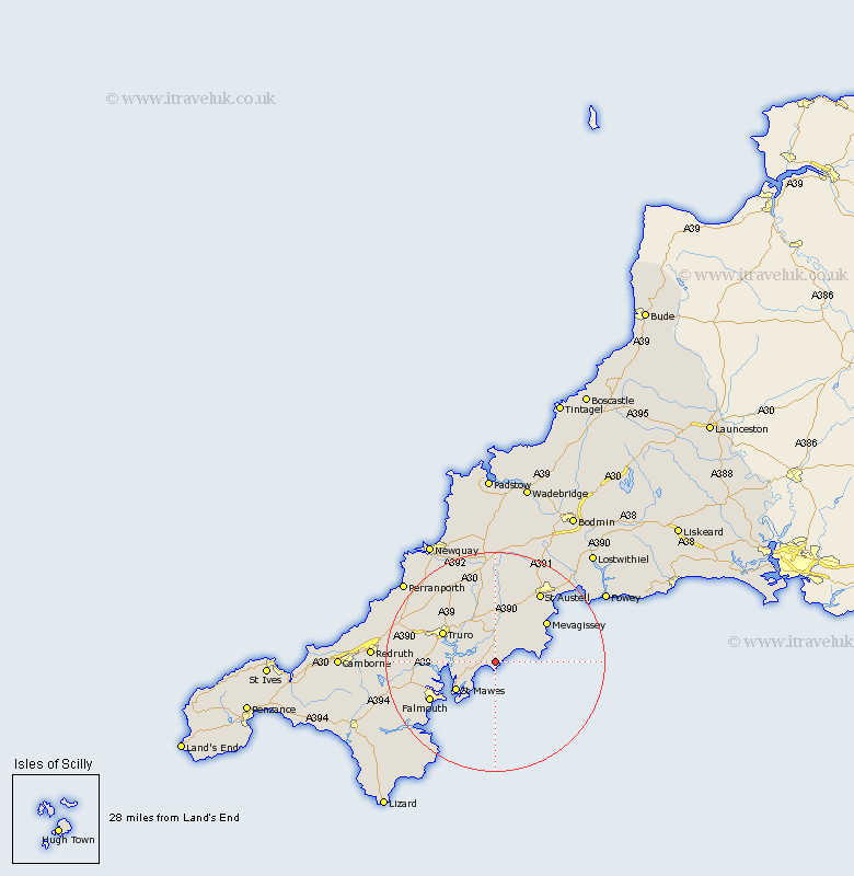
Cornwall Map Showing Location of Veryan
Population: 982
District: Carrick
Easting: 191947 Northing: 39328
Latitude: 50.22 Longitude: -4.92
 = Veryan
District: Carrick
Easting: 191947 Northing: 39328
Latitude: 50.22 Longitude: -4.92
= Veryan
This Veryan map below is supplied by Google. Use the tools in the top left corner to zoom into street level or zoom out for a road map, you may also need to zoom in to see Veryan on the map. Click and drag the map to move around. If the map fails to load try and refresh your browser or zoom in or out (+ or -).
Update - it seems Google no longer allow people to use their maps for free! This Veryan map sometimes loads and sometimes gives a error. I am working on a solution.
Closest 30 Towns or Cities to Veryan (Population over 500)
Tregoney 5.56km Gerrans 7.31km Creed 7.5km Probus 7.77km St Ewe 8.13km Saint Ewe 8.13km St. Ewe 8.13km Kea 9.66km St. Feoch 9.67km Feock 9.67km Saint Feoch 9.67km Saint Feock 9.67km St Feock 9.67km St Feoch 9.67km St. Feock 9.67km Truro 10.99km Mylor 11km Mylor Bridge 11km Ladock 11.37km Kenwyn 12.03km Mevagissey 12.03km Mevegissey 12.03km St. Stephen 13.02km Saint Stephen 13.02km St Stephen 13.02km Falmouth 13.99km Penryn 14.19km St. Austell 15.39km Saint Austell 15.39km St Austell 15.39km