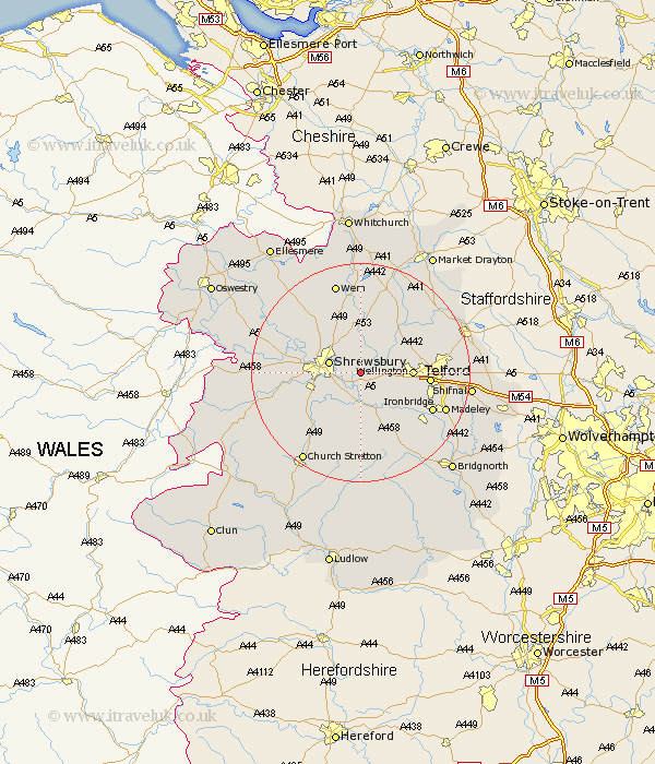
Shropshire Map Showing Location of Upton Magna
Population: 324
District: Shrewsbury and Atcham
Easting: 356080 Northing: 311605
Latitude: 52.7 Longitude: -2.65
 = Upton Magna
District: Shrewsbury and Atcham
Easting: 356080 Northing: 311605
Latitude: 52.7 Longitude: -2.65
= Upton Magna
This Upton Magna map below is supplied by Google. Use the tools in the top left corner to zoom into street level or zoom out for a road map, you may also need to zoom in to see Upton Magna on the map. Click and drag the map to move around. If the map fails to load try and refresh your browser or zoom in or out (+ or -).
Update - it seems Google no longer allow people to use their maps for free! This Upton Magna map sometimes loads and sometimes gives a error. I am working on a solution.
Closest 30 Towns or Cities to Upton Magna (Population over 500)
Rodington 4.33km Wrockwardine 5.62km Shrewsbury 5.91km Ercall Magna 6.5km High Ercall 6.5km Berrington 6.5km Baystonhill 7.69km Cressage 7.75km Hadnall 8.67km Condover 8.74km Wellington 8.98km Shawbury 9.26km Ketley 11.23km Hadley 11.23km Hanwood 11.38km Great Hanwood 11.38km Bicton 11.82km Telford 11.99km Trench 12.49km Cherrington 12.53km Dawley 12.9km Stanton upon Hine Heath 12.98km Stanton 12.98km Much Wenlock 13.01km Ford 13.6km Ironbridge 14.42km Broseley 14.57km Oakengates 14.6km Downington 14.71km Donnington 14.71km