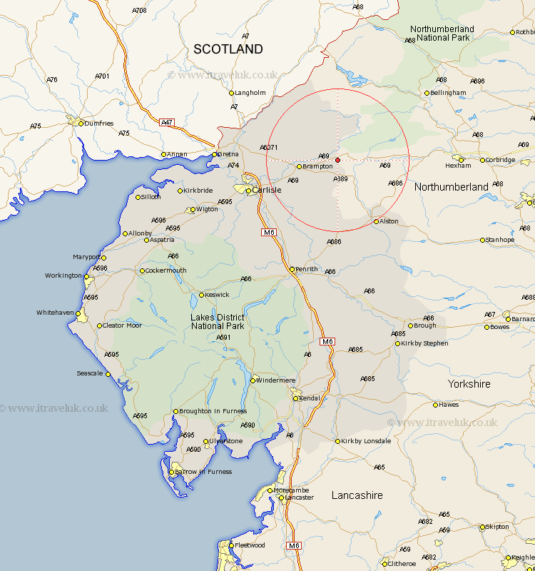
Cumbria Map Showing Location of Upper Denton
Population: 92
District: Carlisle
Easting: 362658 Northing: 563728
Latitude: 54.97 Longitude: -2.58
 = Upper Denton
District: Carlisle
Easting: 362658 Northing: 563728
Latitude: 54.97 Longitude: -2.58
= Upper Denton
This Upper Denton map below is supplied by Google. Use the tools in the top left corner to zoom into street level or zoom out for a road map, you may also need to zoom in to see Upper Denton on the map. Click and drag the map to move around. If the map fails to load try and refresh your browser or zoom in or out (+ or -).
Update - it seems Google no longer allow people to use their maps for free! This Upper Denton map sometimes loads and sometimes gives a error. I am working on a solution.
Closest 30 Towns or Cities to Upper Denton (Population over 500)
Farlam 8.47km Brampton 9.76km Irthington 12.28km Hayton 12.98km Wetheral 18.6km Ainstable 20.87km Kirkoswald 23.46km Stanwix 23.56km Carlisle 24.21km Longtown 24.74km Rockcliff 25.81km Rockcliffe 25.81km Lazonby 27.01km Lasonby 27.01km Dalston 29.57km Burgh-by-Sands 30.32km Burgh 30.32km Burgh by Sands 30.32km Langwathby 31.96km Thursby 33.32km Skelton 34.77km Culgaith 35.23km Hesket Newmarket 37.99km Kirkby Thore 38.98km Wigton 39.15km Caldbeck 39.57km Greystoke 39.62km Bowness-on-Solway 40.48km Bowness on Solway 40.48km Kirkbride 40.48km