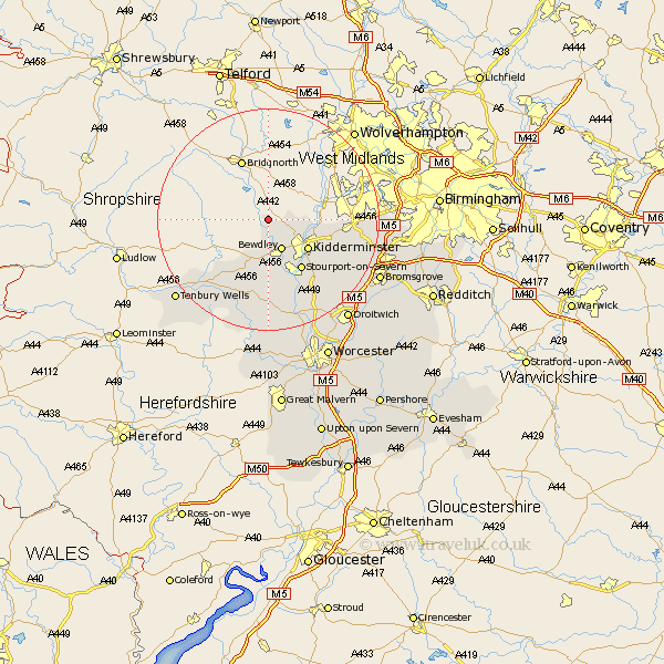
Worcestershire Map Showing Location of Arley
Population: 645
District: Wyre Forest
Easting: 376207 Northing: 281801
Latitude: 52.43 Longitude: -2.35
 = Arley
District: Wyre Forest
Easting: 376207 Northing: 281801
Latitude: 52.43 Longitude: -2.35
= Arley
This Arley map below is supplied by Google. Use the tools in the top left corner to zoom into street level or zoom out for a road map, you may also need to zoom in to see Arley on the map. Click and drag the map to move around. If the map fails to load try and refresh your browser or zoom in or out (+ or -).
Update - it seems Google no longer allow people to use their maps for free! This Arley map sometimes loads and sometimes gives a error. I am working on a solution.
Closest 30 Towns or Cities to Arley (Population over 500)
Bewdley 6km Kidderminster 8.77km Stourport-on-Severn 10.85km Stourport on Severn 10.85km Stourport 10.85km Churchill 11.45km Rock 11.63km Stone 12.59km Hartlebury 13.65km Abberley 14.87km Astley 14.99km Stourbridge 15.15km Lindridge 15.19km Chaddesley Corbett 15.51km Hagley 15.82km Clent 15.93km Belbroughton 16.25km Great Witley 16.68km Netherton 18.9km Dodford 19.33km Great Dodford 19.33km Ombersley 20.15km Halesowen 20.42km Romsley 20.42km Clifton upon Teme 20.88km Clifton 20.88km Holt 21.48km Lickey End 21.66km Lickey 21.66km Tenbury Wells 21.7km