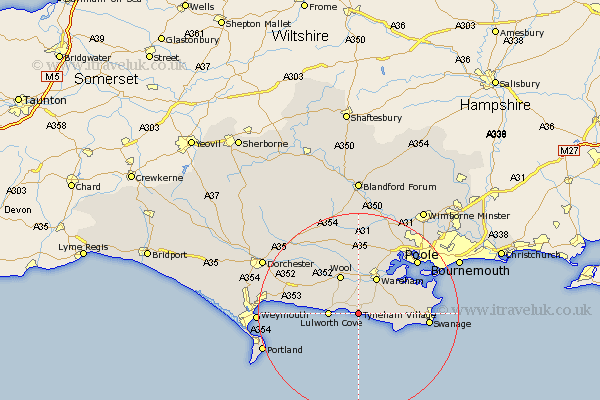
Dorset Map Showing Location of Tyneham Village
District: Purbeck
Easting: 388209 Northing: 79743
Latitude: 50.62 Longitude: -2.17
 = Tyneham Village
Easting: 388209 Northing: 79743
Latitude: 50.62 Longitude: -2.17
= Tyneham Village
This Tyneham Village map below is supplied by Google. Use the tools in the top left corner to zoom into street level or zoom out for a road map, you may also need to zoom in to see Tyneham Village on the map. Click and drag the map to move around. If the map fails to load try and refresh your browser or zoom in or out (+ or -).
Update - it seems Google no longer allow people to use their maps for free! This Tyneham Village map sometimes loads and sometimes gives a error. I am working on a solution.
Closest 30 Towns or Cities to Tyneham Village (Population over 500)
Lulworth Cove 5.88km West Lulworth 5.88km Winfrith 7.97km Winfrith Newburgh 7.97km Wareham 8.2km Corfe Castle 8.44km Wool 8.54km Worth 9.59km Worth Matravers 9.59km Langton Matravers 10.75km Bovington Camp 10.97km Holton Heath Station 12.58km Holton Heath 12.58km Arne 13.2km Osmington 14.23km Swanage 14.24km Upton 14.34km Bere Regis 15.24km Poole 16.18km Lytchett Matravers 16.41km Studland 16.56km Winterborne Kingston 16.84km Broadmayne 16.98km Preston 18.02km Milborne St Andrew 18.59km Milborne 18.59km Milborne St. Andrew 18.59km Milborne Saint Andrew 18.59km Overcombe 18.84km Puddletown 19.66km