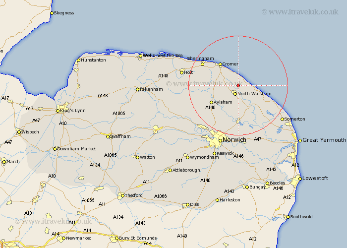
Norfolk Map Showing Location of Trunch
Population: 805
District: North Norfolk
Easting: 628906 Northing: 333507
Latitude: 52.85 Longitude: 1.4
 = Trunch
District: North Norfolk
Easting: 628906 Northing: 333507
Latitude: 52.85 Longitude: 1.4
= Trunch
This Trunch map below is supplied by Google. Use the tools in the top left corner to zoom into street level or zoom out for a road map, you may also need to zoom in to see Trunch on the map. Click and drag the map to move around. If the map fails to load try and refresh your browser or zoom in or out (+ or -).
Update - it seems Google no longer allow people to use their maps for free! This Trunch map sometimes loads and sometimes gives a error. I am working on a solution.
Closest 30 Towns or Cities to Trunch (Population over 500)
Trunch 0km Mundesley 2.17km Mundersley 2.17km North Walsham 3.87km Bacton 4.48km Walcott 6.97km Northrepps 7.14km Felmingham 7.14km Roughton 7.67km Worstead 7.75km Overstrand 8.14km Smallburgh 9.85km Erpingham 10.24km Cromer 11.44km Happisburgh 11.79km Little Hautbois 11.99km Lammas 11.99km Lamas Little Hautbois 11.99km Stalham 12.14km Aylsham 12.51km Coltishall 13.16km Beeston St Lawrence 13.4km Beeston Saint Lawrence 13.4km Beeston St. Lawrence 13.4km Beeston 13.4km Runton 13.68km West Runton 13.68km Marsham 13.69km Neatishead 13.73km Hevingham 14.28km