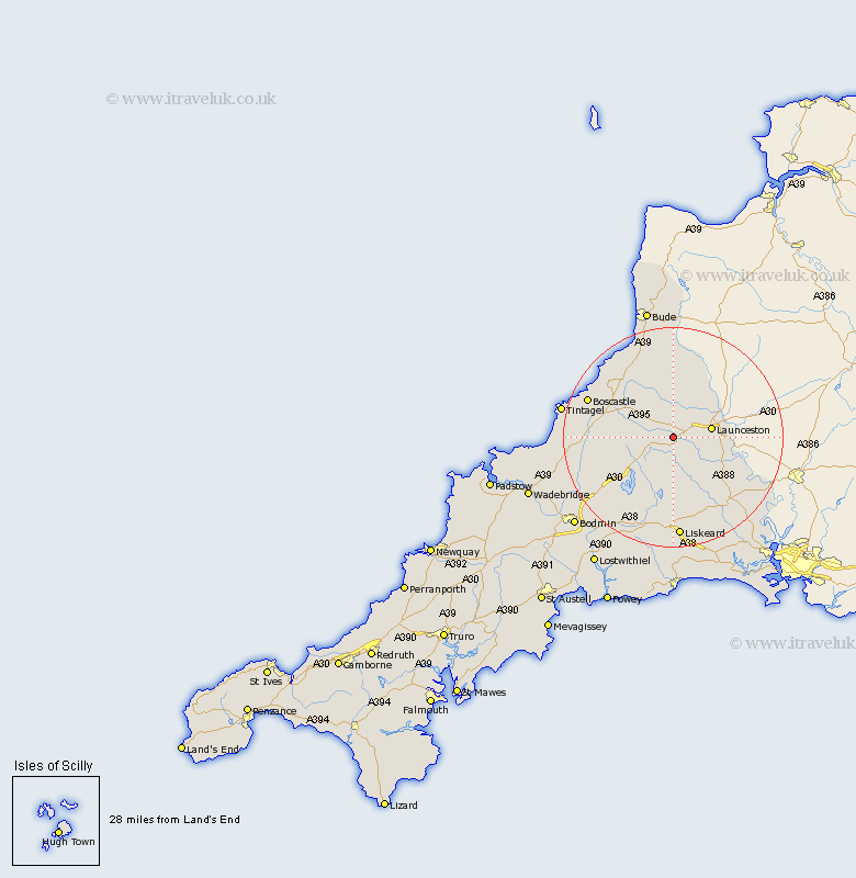
Cornwall Map Showing Location of Trewen
Population: 134
District: North Cornwall
Easting: 225519 Northing: 82634
Latitude: 50.62 Longitude: -4.47
 = Trewen
District: North Cornwall
Easting: 225519 Northing: 82634
Latitude: 50.62 Longitude: -4.47
= Trewen
This Trewen map below is supplied by Google. Use the tools in the top left corner to zoom into street level or zoom out for a road map, you may also need to zoom in to see Trewen on the map. Click and drag the map to move around. If the map fails to load try and refresh your browser or zoom in or out (+ or -).
Update - it seems Google no longer allow people to use their maps for free! This Trewen map sometimes loads and sometimes gives a error. I am working on a solution.
Closest 30 Towns or Cities to Trewen (Population over 500)
Lewannick 3km Altarnun 5.06km South Petherwin 5.88km Launceston 7.29km North Petherwin 7.77km North Hill 7.78km Lezant 9.03km Linkinhorne 11.66km Camelford 15.29km Callington 17.52km Pounstock 17.68km Poundstock 17.68km Liskeard 18.57km Dobwalls 18.87km Blisland 18.92km Forrabury 19.12km Cardinham 19.69km Cardingham 19.69km Marhamchurch 20.68km Markhamchurch 20.68km Menheniot 20.7km Tintagel 20.74km Calstock 23.98km Bere Alston 23.98km Bodmin 24.3km Bude 24.54km Morval 25.98km Duloe 25.98km Lanreath 26.9km Lostwithiel 27.94km