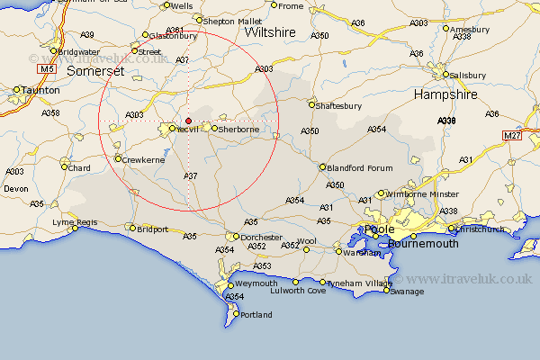
Dorset Map Showing Location of Trent
Population: 320
District: West Dorset
Easting: 359042 Northing: 118809
Latitude: 50.97 Longitude: -2.58
 = Trent
District: West Dorset
Easting: 359042 Northing: 118809
Latitude: 50.97 Longitude: -2.58
= Trent
This Trent map below is supplied by Google. Use the tools in the top left corner to zoom into street level or zoom out for a road map, you may also need to zoom in to see Trent on the map. Click and drag the map to move around. If the map fails to load try and refresh your browser or zoom in or out (+ or -).
Update - it seems Google no longer allow people to use their maps for free! This Trent map sometimes loads and sometimes gives a error. I am working on a solution.
Closest 30 Towns or Cities to Trent (Population over 500)
Bradford Abbas 5.56km Sherborne 6.12km Sherbourne 6.12km Yetminster 7.51km Leigh 11.36km Stalbridge 15.29km Buckland Newton 17.53km Mosterton 18.27km Marnhull 18.67km Cerne Abbas 20.26km Bourton 20.72km Stour Provost 21.09km Stour 21.32km East Stour 21.32km Sturminster Newton 21.74km Beaminster 21.92km Maiden Newton 22.27km Broadwindsor 22.56km Broadwinsor 22.56km Gillingham 23.36km Netherbury 23.51km Piddletrenthide 23.51km Puddletrenthide 23.51km Shillingstone 24.51km Child Okeford 25.15km Motcombe 26.26km Thorncombe 26.85km Shaftesbury 27.09km Loders 27.59km Charminster 27.59km