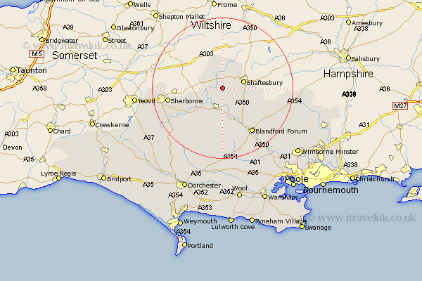
Dorset Map Showing Location of Todber
Population: 124
District: North Dorset
Easting: 380113 Northing: 120531
Latitude: 50.98 Longitude: -2.28
 = Todber
District: North Dorset
Easting: 380113 Northing: 120531
Latitude: 50.98 Longitude: -2.28
= Todber
This Todber map below is supplied by Google. Use the tools in the top left corner to zoom into street level or zoom out for a road map, you may also need to zoom in to see Todber on the map. Click and drag the map to move around. If the map fails to load try and refresh your browser or zoom in or out (+ or -).
Update - it seems Google no longer allow people to use their maps for free! This Todber map sometimes loads and sometimes gives a error. I am working on a solution.
Closest 30 Towns or Cities to Todber (Population over 500)
Stour 1.86km East Stour 1.86km Marnhull 2.98km Gillingham 5.68km Motcombe 5.96km Shaftesbury 6.12km Stalbridge 6.91km Sturminster Newton 7.41km Fontmell Magna 7.92km Child Okeford 8.19km Iwerne Minster 8.94km Shillingstone 9.55km Bourton 9.91km Charlton 10.5km Stourpaine 12.56km Pimperne 15.3km Blandford 15.33km Blandford Forum 15.33km Sherborne 15.62km Sherbourne 15.62km Winterborne Stickland 17.04km Stickland Winterborne 17.04km Tarrant Monkton 19.09km Handley 20.18km Buckland Newton 20.37km Milton Abbas 20.38km Whitechurch 20.68km Spetisbury 21.9km Yetminster 21.91km Bradford Abbas 22.28km