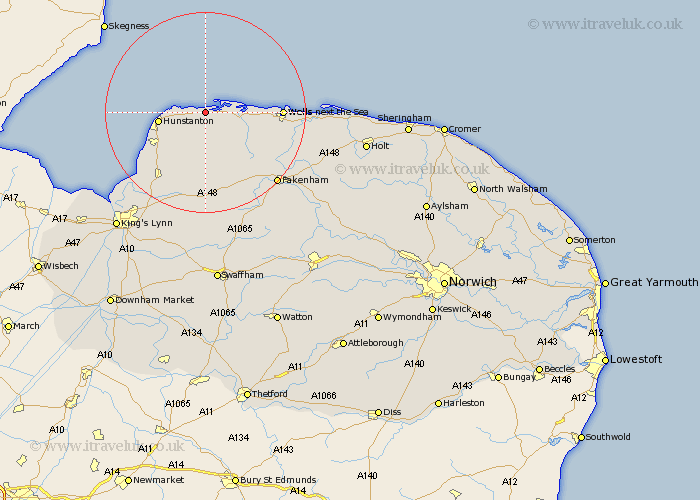
Norfolk Map Showing Location of Titchwell
Population: 91
District: King's Lynn and West Norfolk
Easting: 576825 Northing: 344317
Latitude: 52.97 Longitude: 0.63
 = Titchwell
District: King's Lynn and West Norfolk
Easting: 576825 Northing: 344317
Latitude: 52.97 Longitude: 0.63
= Titchwell
This Titchwell map below is supplied by Google. Use the tools in the top left corner to zoom into street level or zoom out for a road map, you may also need to zoom in to see Titchwell on the map. Click and drag the map to move around. If the map fails to load try and refresh your browser or zoom in or out (+ or -).
Update - it seems Google no longer allow people to use their maps for free! This Titchwell map sometimes loads and sometimes gives a error. I am working on a solution.
Closest 30 Towns or Cities to Titchwell (Population over 500)
Brancaster 1.12km Burnham Market 6.95km Docking 7.5km Hunstanton 9.12km Sedgeford 9.28km Heacham 11.49km South Creake 12.88km Great Bircham 12.98km Bircham 12.98km Ingoldisthorpe 13.6km Ingoldesthorpe 13.6km Syderstone 14.13km Snettisham 14.27km Wells on Sea 14.51km Wells 14.51km Wells-on-Sea 14.51km Wells-next-the-Sea 14.51km Wells next the Sea 14.51km Dersingham 15.76km Tatterset 16.28km Tattersett 16.28km East Rudham 17.59km Sculthorpe 17.88km Little Walsingham 19.15km Walsingham 19.15km Fakenham 20km Little Snoring 22.1km Massingham 22.35km Great Massingham 22.35km Grimston 22.93km