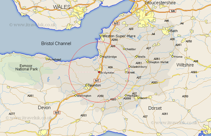
Somerset Map Showing Location of Bridgewater
Population: 34056
Area Size (ha): 888
District: Sedgemoor
Easting: 330014 Northing: 135801
Latitude: 51.12 Longitude: -3
 = Bridgewater
Area Size (ha): 888
District: Sedgemoor
Easting: 330014 Northing: 135801
Latitude: 51.12 Longitude: -3
= Bridgewater
This Bridgewater map below is supplied by Google. Use the tools in the top left corner to zoom into street level or zoom out for a road map, you may also need to zoom in to see Bridgewater on the map. Click and drag the map to move around. If the map fails to load try and refresh your browser or zoom in or out (+ or -).
Update - it seems Google no longer allow people to use their maps for free! This Bridgewater map sometimes loads and sometimes gives a error. I am working on a solution.
Closest 30 Towns or Cities to Bridgewater (Population over 500)
North Petherton 2.19km Durleigh 3.49km Weston Zoyland 4.65km Puriton 6.03km Cossington 6.89km Middlezoy 7.22km Pawlett 7.41km Spaxton 8.14km West Monkton 8.2km Othery 8.95km Huntspill 9.34km Otterhampton 9.41km Kingston 9.86km Stoke St. Gregory 10.38km Stoke Saint Gregory 10.38km Stoke St Gregory 10.38km Highbridge 11.18km Creech St Michael 11.18km Creech Saint Michael 11.18km Creech St. Michael 11.18km North Curry 11.36km Shapwick 11.78km Stogursey 11.89km Stoke Courcy 11.89km Stokscourey 11.89km Nether Stowey 12.21km Taunton 12.35km Burnham on Sea 12.97km Burnham 12.97km Burnham-on-Sea 12.97km