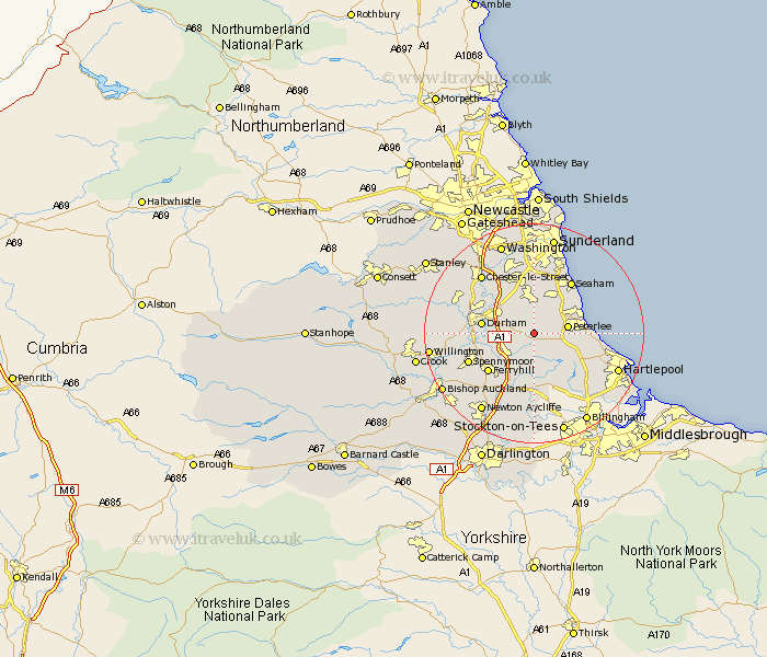
Durham Map Showing Location of Thornley
Population: 2946
Area Size (ha): 55
District: Easington
Easting: 436470 Northing: 539608
Latitude: 54.75 Longitude: -1.43
 = Thornley
Area Size (ha): 55
District: Easington
Easting: 436470 Northing: 539608
Latitude: 54.75 Longitude: -1.43
= Thornley
This Thornley map below is supplied by Google. Use the tools in the top left corner to zoom into street level or zoom out for a road map, you may also need to zoom in to see Thornley on the map. Click and drag the map to move around. If the map fails to load try and refresh your browser or zoom in or out (+ or -).
Update - it seems Google no longer allow people to use their maps for free! This Thornley map sometimes loads and sometimes gives a error. I am working on a solution.
Closest 30 Towns or Cities to Thornley (Population over 500)
Sherburn 3.71km Wingate 3.71km Haswell 3.85km Shotton 5.66km Coxhoe 5.66km Bowburn 5.66km Trimdon 5.66km Peterlee 5.67km South Hetton 5.96km Easington 6.17km Pittington 6.42km Hutton Henry 6.51km Shincliffe 6.68km Fishburn 7.42km Hesleden 7.49km Hetton le Hole 7.49km Murton 7.49km Cornforth 7.72km West Cornforth 7.72km Bishop Middleham 8.08km West Rainton 8.56km Dalton le Dale 8.56km Dalton 8.56km Durham 8.75km Horden 9.63km Seaton 9.8km Ferryhill 10.54km Sedgefield 11.12km Hart 11.32km Houghton le Spring 11.32km