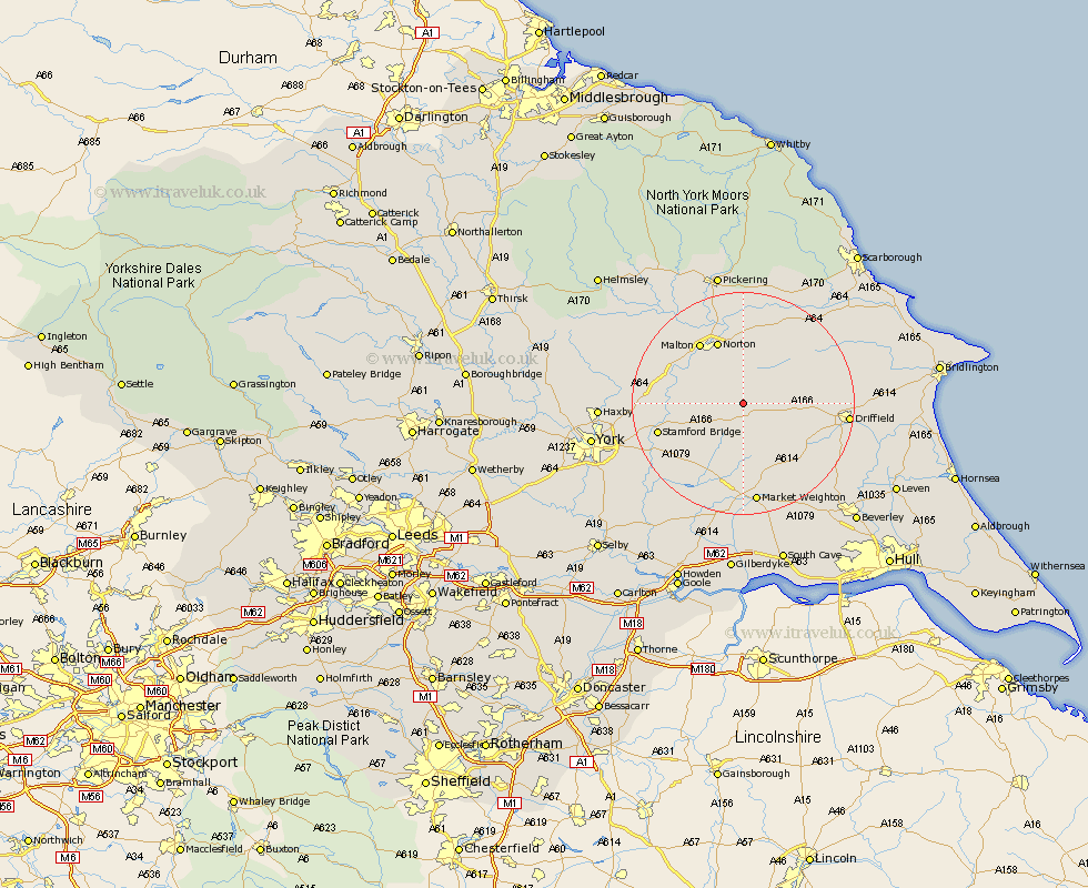
Yorkshire Map Showing Location of Thixendale
Population: 166
District: Ryedale
Easting: 485135 Northing: 460504
Latitude: 54.03 Longitude: -0.7
 = Thixendale
District: Ryedale
Easting: 485135 Northing: 460504
Latitude: 54.03 Longitude: -0.7
= Thixendale
This Thixendale map below is supplied by Google. Use the tools in the top left corner to zoom into street level or zoom out for a road map, you may also need to zoom in to see Thixendale on the map. Click and drag the map to move around. If the map fails to load try and refresh your browser or zoom in or out (+ or -).
Update - it seems Google no longer allow people to use their maps for free! This Thixendale map sometimes loads and sometimes gives a error. I am working on a solution.
Closest 30 Towns or Cities to Thixendale (Population over 500)
Wetwang 9.47km Fangfoss 11.44km Pocklington 11.59km Norton 12.29km Rillington 12.98km Malton 13.23km Barmby-on-the-Moor 13.49km Barmby 13.49km Barmby on the Moor 13.49km Wilberfoss 15.15km Stamford Bridge 15.21km North Frodingham 15.98km Driffield 17.67km Market Weighton 18.65km Great Driffield 18.92km Sherburn 19.05km Slingsby 19.18km Sutton 19.21km Sutton upon Derwent 19.21km Yedingham 19.32km Melbourne 19.35km Terrington 19.71km Cranswick 19.74km Sheriff Hutton 20.35km Lockington 20.51km Nafferton 20.77km Snainton 21.76km Seaton Ross 21.77km Strensall 21.84km Kilham 21.84km