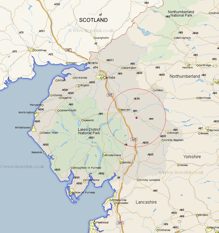
Cumbria Map Showing Location of Temple Sowerby
Population: 333
District: Eden
Easting: 361257 Northing: 524794
Latitude: 54.62 Longitude: -2.6
 = Temple Sowerby
District: Eden
Easting: 361257 Northing: 524794
Latitude: 54.62 Longitude: -2.6
= Temple Sowerby
This Temple Sowerby map below is supplied by Google. Use the tools in the top left corner to zoom into street level or zoom out for a road map, you may also need to zoom in to see Temple Sowerby on the map. Click and drag the map to move around. If the map fails to load try and refresh your browser or zoom in or out (+ or -).
Update - it seems Google no longer allow people to use their maps for free! This Temple Sowerby map sometimes loads and sometimes gives a error. I am working on a solution.
Closest 30 Towns or Cities to Temple Sowerby (Population over 500)
Kirkby Thore 3.22km Culgaith 3.7km Long Marston 5.68km Long Marton 5.68km Langwathby 8.56km Appleby 9.35km Crosby Ravensworth 11.17km Shap 11.92km Lasonby 14.47km Lazonby 14.47km Dacre 15.02km Orton 16.82km Greystoke 17.56km Kirkoswald 17.87km Skelton 19.49km Ainstable 22.11km Tebay 22.26km Brough 22.31km Kirkby Stephen 23.2km Ravenstonedale 25.19km Hesket Newmarket 29.76km Wetheral 31.08km Staveley 31.12km Caldbeck 31.7km Ambleside 32.48km Hayton 32.94km Koswick 33.33km Keswick 33.33km Farlam 33.78km Sedbergh 33.79km