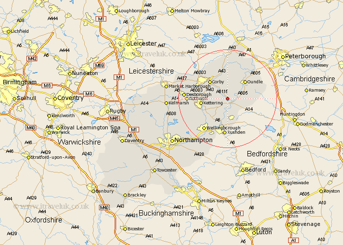
Northamptonshire Map Showing Location of Sudborough
Population: 189
District: East Northamptonshire
Easting: 497470 Northing: 280864
Latitude: 52.42 Longitude: -0.57
 = Sudborough
District: East Northamptonshire
Easting: 497470 Northing: 280864
Latitude: 52.42 Longitude: -0.57
= Sudborough
This Sudborough map below is supplied by Google. Use the tools in the top left corner to zoom into street level or zoom out for a road map, you may also need to zoom in to see Sudborough on the map. Click and drag the map to move around. If the map fails to load try and refresh your browser or zoom in or out (+ or -).
Update - it seems Google no longer allow people to use their maps for free! This Sudborough map sometimes loads and sometimes gives a error. I am working on a solution.
Closest 30 Towns or Cities to Sudborough (Population over 500)
Thrapston 2.93km Brigstock 4.34km Islip 4.35km Woodford 5.56km Titchmarsh 5.95km Ringstead 7.5km Stanion 7.92km Geddington 8.12km Weldon 8.67km Raunds 9.55km Corby 10.04km Oundle 10.04km Burton Latimer 10.05km Finedon 10.32km Kettering 10.34km Stanwick 11.18km Irthlingborough 11.35km Isham 11.7km Higham Ferrers 13.03km Cottingham 14.46km Warmington 14.6km Gretton 14.63km Broughton 14.67km Rushden 14.88km Caldecott 15.06km Wellingborough 15.82km Rothwell 15.82km Rowell 15.82km Desborough 17.05km Kings Cliffe 17.28km