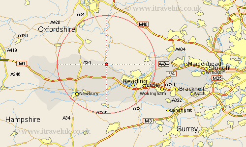
Berkshire Map Showing Location of Streatley
Population: 4053
Area Size (ha): 186
Easting: 458973 Northing: 180149
Latitude: 51.52 Longitude: -1.15
 = Streatley
Area Size (ha): 186
Easting: 458973 Northing: 180149
Latitude: 51.52 Longitude: -1.15
= Streatley
This Streatley map below is supplied by Google. Use the tools in the top left corner to zoom into street level or zoom out for a road map, you may also need to zoom in to see Streatley on the map. Click and drag the map to move around. If the map fails to load try and refresh your browser or zoom in or out (+ or -).
Update - it seems Google no longer allow people to use their maps for free! This Streatley map sometimes loads and sometimes gives a error. I am working on a solution.
Closest 30 Towns or Cities to Streatley (Population over 500)
Streatley 0km Basildon 2.96km Pangbourne 5.92km Compton 6.92km Bradfield 9.35km East Ilsley 9.41km Bucklebury 9.9km Theale 10.92km Tilehurst 10.97km Hermitage 10.97km Beenham 11.12km Cold Ash 13.1km Chieveley 13.72km Reading 13.93km Aldermaston 14.83km Burghfield 15.29km Thatcham 15.29km Shaw 16.63km Brimpton 16.84km Newbury 17.37km Greenham 17.48km Earley 17.64km Sonning 18.18km Remenham 18.54km Welford 18.83km Shinfield 18.98km Speen 18.98km Mortimer 19.07km Stratfield Mortimer 19.07km Woodley 19.9km