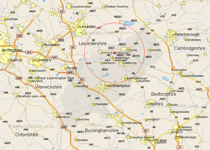
Northamptonshire Map Showing Location of Stoke Albany
Population: 330
District: Kettering
Easting: 481511 Northing: 286135
Latitude: 52.47 Longitude: -0.8
 = Stoke Albany
District: Kettering
Easting: 481511 Northing: 286135
Latitude: 52.47 Longitude: -0.8
= Stoke Albany
This Stoke Albany map below is supplied by Google. Use the tools in the top left corner to zoom into street level or zoom out for a road map, you may also need to zoom in to see Stoke Albany on the map. Click and drag the map to move around. If the map fails to load try and refresh your browser or zoom in or out (+ or -).
Update - it seems Google no longer allow people to use their maps for free! This Stoke Albany map sometimes loads and sometimes gives a error. I am working on a solution.
Closest 30 Towns or Cities to Stoke Albany (Population over 500)
Wilbarston 1.85km Cottingham 3.86km Desborough 3.88km Rothwell 5.56km Rowell 5.56km Caldecott 7.92km Geddington 8.73km Corby 9.22km Kettering 9.32km Stanion 10.16km Broughton 11.35km Weldon 11.44km Clipston 11.59km Gretton 11.68km Brigstock 13.68km Isham 14.64km Walgrave 14.87km Naseby 15.51km Burton Latimer 15.82km Welford 17.83km Brixworth 18.01km Finedon 18.65km Woodford 19.34km Pitsford 19.38km Spratton 19.54km Thrapston 19.54km Wellingborough 19.74km Guilsborough 20.1km Islip 20.32km Sywell 20.42km