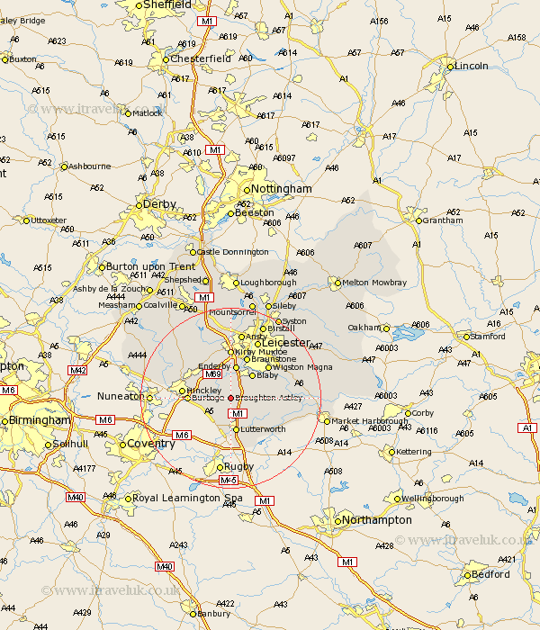
Leicestershire Map Showing Location of Broughton Astley
Population: 6403
Area Size (ha): 149
District: Harborough
Easting: 453149 Northing: 291308
Latitude: 52.52 Longitude: -1.22
 = Broughton Astley
Area Size (ha): 149
District: Harborough
Easting: 453149 Northing: 291308
Latitude: 52.52 Longitude: -1.22
= Broughton Astley
This Broughton Astley map below is supplied by Google. Use the tools in the top left corner to zoom into street level or zoom out for a road map, you may also need to zoom in to see Broughton Astley on the map. Click and drag the map to move around. If the map fails to load try and refresh your browser or zoom in or out (+ or -).
Update - it seems Google no longer allow people to use their maps for free! This Broughton Astley map sometimes loads and sometimes gives a error. I am working on a solution.
Closest 30 Towns or Cities to Broughton Astley (Population over 500)
Sapcote 3.38km Stoney Stanton 3.85km Croft 3.87km Cosby 4.34km Sharnford 4.51km Claybrooke Parva 5.02km Claybrooke 5.02km Little Claybrooke 5.02km Narborough 5.67km Whetstone 6km Ullesthorpe 6km Elmesthorpe 6.74km Elmsthorpe 6.74km Countesthorpe 6.74km Blaby 7.16km Gilmarton 7.16km Gilmorton 7.16km Enderby 7.49km Lutterworth 7.5km Glen Parka 8.75km Glen Parva 8.75km Walton-in-Knaptoft 8.76km Walton 8.76km Burbage 9.02km Braunstone 9.86km Hinckley 10.31km Wigston 10.82km Wigston Magna 10.82km Kirby Muxloe 11.12km Oadby 11.67km