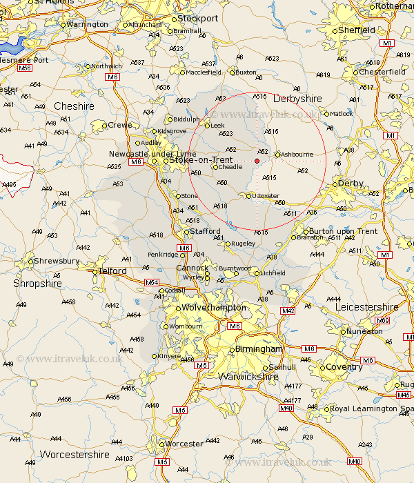
Staffordshire Map Showing Location of Stanton
Population: 232
District: East Staffordshire
Easting: 412302 Northing: 344792
Latitude: 53 Longitude: -1.82
 = Stanton
District: East Staffordshire
Easting: 412302 Northing: 344792
Latitude: 53 Longitude: -1.82
= Stanton
This Stanton map below is supplied by Google. Use the tools in the top left corner to zoom into street level or zoom out for a road map, you may also need to zoom in to see Stanton on the map. Click and drag the map to move around. If the map fails to load try and refresh your browser or zoom in or out (+ or -).
Update - it seems Google no longer allow people to use their maps for free! This Stanton map sometimes loads and sometimes gives a error. I am working on a solution.
Closest 30 Towns or Cities to Stanton (Population over 500)
Mayfield 3.35km Denston 4.32km Denstone 4.32km Waterhouses 4.99km Rocester 5.67km Alton 5.8km Oakamoor 6.69km Ipstones 10.7km Kingsley 11.3km Cheadle 11.31km Uttoxeter 11.34km Checkley 11.61km Church Leigh 13.67km Leigh 13.67km Marchington 14.86km Draycott in the Moors 14.97km Draycott 14.97km Cheddleton 15.52km Caverswall 16.84km Leek 17.39km Fulford 17.64km Hatton 18.9km Tutbury 18.92km Hanbury 19.36km Hilderstone 20.12km Abbots Bromley 20.87km Rolleston 21.64km Horton 22.04km Endon 22.09km Anslow 22.26km