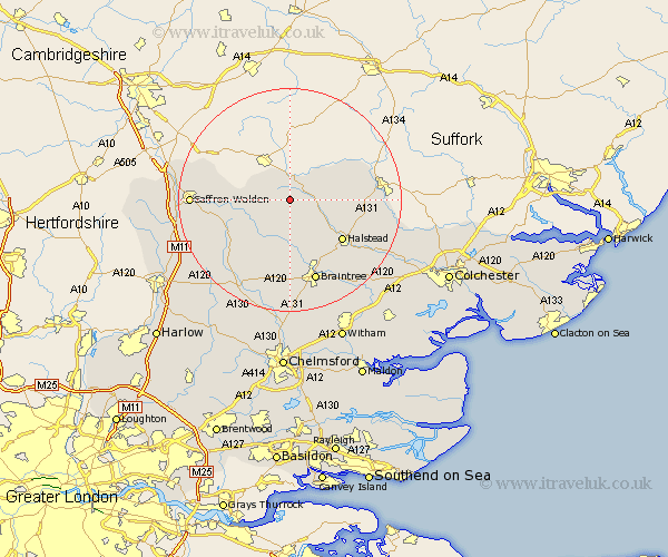
Essex Map Showing Location of Stambourne
Population: 401
District: Braintree
Easting: 571532 Northing: 238361
Latitude: 52.02 Longitude: 0.5
 = Stambourne
District: Braintree
Easting: 571532 Northing: 238361
Latitude: 52.02 Longitude: 0.5
= Stambourne
This Stambourne map below is supplied by Google. Use the tools in the top left corner to zoom into street level or zoom out for a road map, you may also need to zoom in to see Stambourne on the map. Click and drag the map to move around. If the map fails to load try and refresh your browser or zoom in or out (+ or -).
Update - it seems Google no longer allow people to use their maps for free! This Stambourne map sometimes loads and sometimes gives a error. I am working on a solution.
Closest 30 Towns or Cities to Stambourne (Population over 500)
Toppesfield 2.94km Steeple Bumpstead 3.89km Ridgwell 4.35km Ridgewell 4.35km Yeldham 4.56km Great Yeldham 4.56km Finchingfield 6.53km Wethersfield 7.5km Great Sampford 7.79km Castle Hedingham 7.79km Sible Hedingham 7.97km Shalford 9.27km Great Bardfield 9.34km Gosfield 10.89km Radwinter 11.56km Thaxted 11.76km Halstead 11.76km Bulmer 12.55km Gwimbach 12.68km Winebisc 12.68km Wimbish 12.68km Wenbech 12.68km Wymbyshe 12.68km Winbeche 12.68km Wimbeis 12.68km Ashdon 13.08km Panfield 14.88km Braintree 15.52km Stebbing 15.89km Earls Colne 16.54km