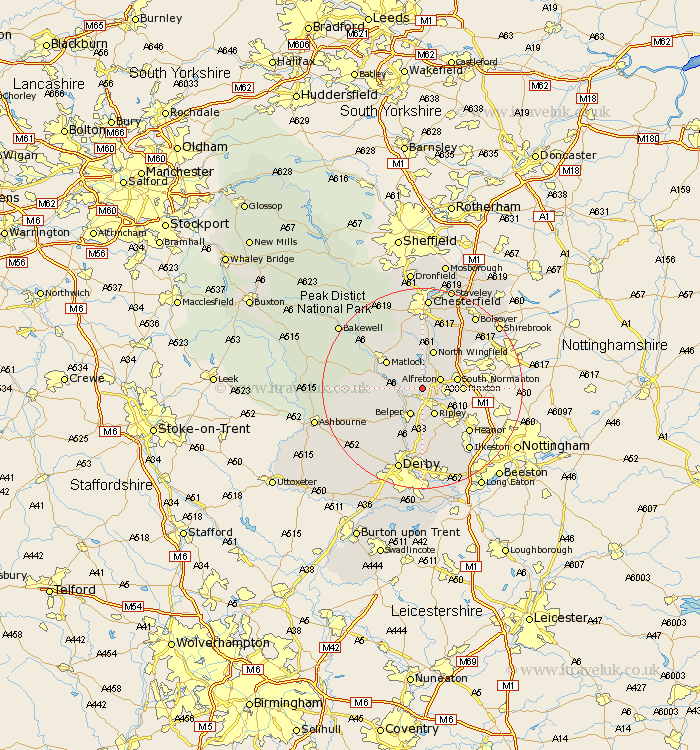
Derbyshire Map Showing Location of Wingfield
Population: 1481
District: Amber Valley
Easting: 437952 Northing: 354192
Latitude: 53.08 Longitude: -1.43
 = Wingfield
District: Amber Valley
Easting: 437952 Northing: 354192
Latitude: 53.08 Longitude: -1.43
= Wingfield
This Wingfield map below is supplied by Google. Use the tools in the top left corner to zoom into street level or zoom out for a road map, you may also need to zoom in to see Wingfield on the map. Click and drag the map to move around. If the map fails to load try and refresh your browser or zoom in or out (+ or -).
Update - it seems Google no longer allow people to use their maps for free! This Wingfield map sometimes loads and sometimes gives a error. I am working on a solution.
Closest 30 Towns or Cities to Wingfield (Population over 500)
Swanwick 2.89km Crich 3.34km Alfreton 3.82km Shirland 4.33km Ambergate Junction Station 4.99km Ambergate 4.99km Stretton 5.67km Heage 5.67km Belper 5.99km Ripley 5.99km Morton 6.48km South Normanton 6.93km Codnor 7.12km Clay Cross 7.5km Blackwell 7.64km Denby 7.73km Pinxton 7.79km Tansley 7.86km North Wingfield 8.07km Matlock Bath 8.41km Pilsley 8.65km Tibshelf 8.69km Matlock 8.69km Wirksworth 8.91km Cromford 9.1km Kilburn 9.26km Kilbourn 9.26km Kilbourne 9.26km Holbrook 9.53km Ashover 9.86km