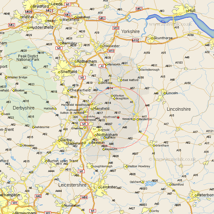
Nottinghamshire Map Showing Location of Southwell
Population: 6446
Area Size (ha): 187
District: Newark and Sherwood
Easting: 470349 Northing: 352710
Latitude: 53.08 Longitude: -0.96
 = Southwell
Area Size (ha): 187
District: Newark and Sherwood
Easting: 470349 Northing: 352710
Latitude: 53.08 Longitude: -0.96
= Southwell
This Southwell map below is supplied by Google. Use the tools in the top left corner to zoom into street level or zoom out for a road map, you may also need to zoom in to see Southwell on the map. Click and drag the map to move around. If the map fails to load try and refresh your browser or zoom in or out (+ or -).
Update - it seems Google no longer allow people to use their maps for free! This Southwell map sometimes loads and sometimes gives a error. I am working on a solution.
Closest 30 Towns or Cities to Southwell (Population over 500)
Fiskerton Ferry 5.19km Fiskerton 5.19km Farnsfield 5.39km Bleasby 5.46km Bilsthorpe 7.71km Oxton 7.86km Farndon 8.06km Elston 9.38km Newark upon Trent 9.68km Newark on Trent 9.68km Newark-on-Trent 9.68km Newark 9.68km Claverton 9.72km Calverton 9.72km Woodborough 9.99km Muskham 10.42km North Muskham 10.42km Rainworth 11.24km Flintham 11.45km Blidworth 11.58km Burton Joyce 11.78km Balderton 11.89km Winthorpe 12.01km East Bridgford 12.58km Lambley 12.87km Shelford 13.12km Clipstone 13.45km Edwinstowe 13.54km Boughton 13.56km Coddington 14.03km