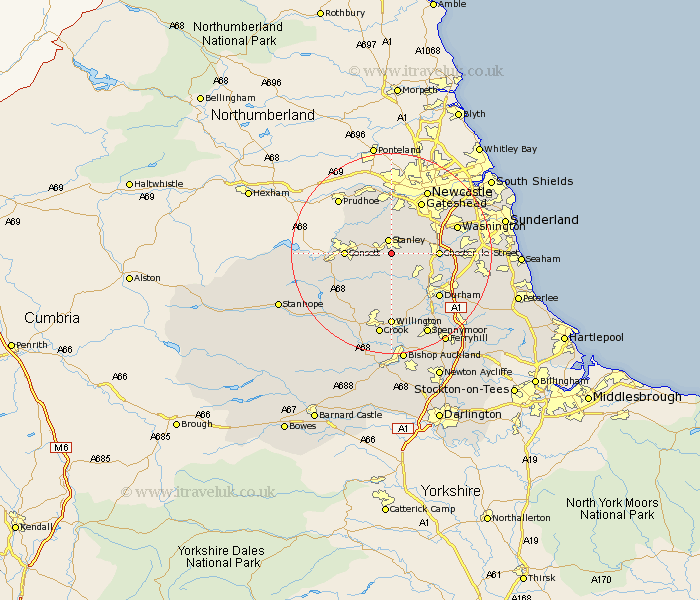
Durham Map Showing Location of South Moor
District: Derwentside
Easting: 419260 Northing: 550628
Latitude: 54.85 Longitude: -1.7
 = South Moor
Easting: 419260 Northing: 550628
Latitude: 54.85 Longitude: -1.7
= South Moor
This South Moor map below is supplied by Google. Use the tools in the top left corner to zoom into street level or zoom out for a road map, you may also need to zoom in to see South Moor on the map. Click and drag the map to move around. If the map fails to load try and refresh your browser or zoom in or out (+ or -).
Update - it seems Google no longer allow people to use their maps for free! This South Moor map sometimes loads and sometimes gives a error. I am working on a solution.
Closest 30 Towns or Cities to South Moor (Population over 500)
Annfield Plain 2.13km Stanley 2.69km Edmondsley 4.27km Lanchester 4.27km Burnopfield 5.66km Langley Park 5.96km Sacriston 6.5km Pelton 6.66km Leadgate 6.66km Witton Gilbert 7.01km Ouston Moor 7.2km Ouston 7.2km Esh 7.42km Rowlands Gill 7.72km Ushaw Moor 8.08km Consett 8.54km Consetti 8.54km Chester-le-Street 8.54km Cornsay 8.56km Birtley 9.3km Whickham 9.32km Lamesley 9.79km Castleside 10.83km Gateshead-on-Tyne 11.81km Gateshead on Tyne 11.81km Gateshead 11.81km Brandon 12.34km Durham 12.6km Blaydon 12.98km Washington 12.98km