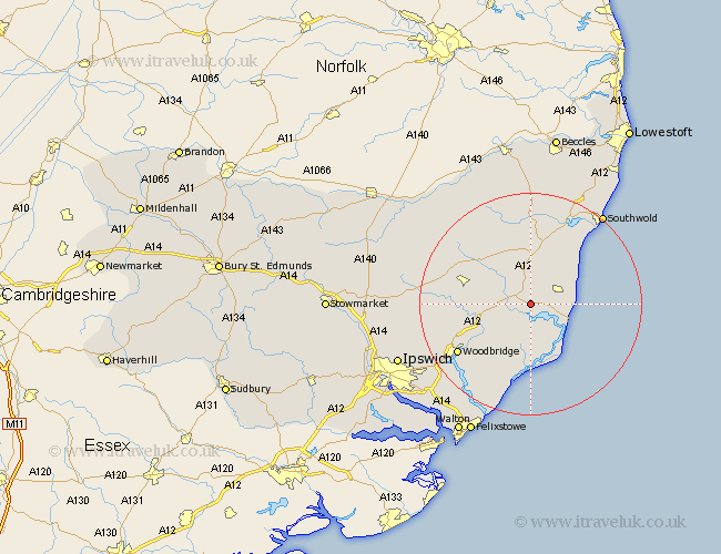
Suffolk Map Showing Location of Snape
Population: 623
District: Suffolk Coastal
Easting: 639234 Northing: 259714
Latitude: 52.18 Longitude: 1.5
 = Snape
District: Suffolk Coastal
Easting: 639234 Northing: 259714
Latitude: 52.18 Longitude: 1.5
= Snape
This Snape map below is supplied by Google. Use the tools in the top left corner to zoom into street level or zoom out for a road map, you may also need to zoom in to see Snape on the map. Click and drag the map to move around. If the map fails to load try and refresh your browser or zoom in or out (+ or -).
Update - it seems Google no longer allow people to use their maps for free! This Snape map sometimes loads and sometimes gives a error. I am working on a solution.
Closest 30 Towns or Cities to Snape (Population over 500)
Saxmundham 3.71km Leiston 4.91km Tunstall 6.52km Aldeburgh 7.76km Thorpeness 8.17km Thorpe 8.17km Rendlesham 9.34km Yoxford 9.34km Wickham Market 9.82km Orford 11.35km Framlingham 11.95km Ufford 12.63km Cookley 15.22km Wenhaston 15.22km Hollesley 15.51km Melton 15.57km Woodbridge 15.57km Laxfield 15.84km Dennington 16.48km Sutton 16.52km Holton 16.72km Martlesham 17.61km Halesworth 18.54km Otley 18.56km Worlingworth 19.39km Grundisburgh 19.41km Martlesham Heath 19.67km Wangford 20.17km Southwold 20.83km Reydon 21.73km