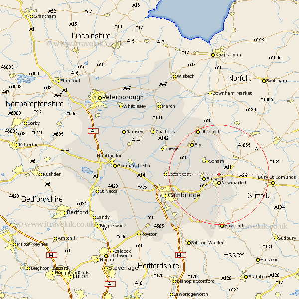
Cambridgeshire Map Showing Location of Snailwell
Population: 224
District: East Cambridgeshire
Easting: 564828 Northing: 267811
Latitude: 52.28 Longitude: 0.42
 = Snailwell
District: East Cambridgeshire
Easting: 564828 Northing: 267811
Latitude: 52.28 Longitude: 0.42
= Snailwell
This Snailwell map below is supplied by Google. Use the tools in the top left corner to zoom into street level or zoom out for a road map, you may also need to zoom in to see Snailwell on the map. Click and drag the map to move around. If the map fails to load try and refresh your browser or zoom in or out (+ or -).
Update - it seems Google no longer allow people to use their maps for free! This Snailwell map sometimes loads and sometimes gives a error. I am working on a solution.
Closest 30 Towns or Cities to Snailwell (Population over 500)
Chippenham 2.18km Fordham 2.18km Isleham 5.56km Burwell 5.96km Soham 7.17km Wicken 8.15km Cheveley 8.15km Ashley 8.69km Swaffham Prior 8.76km Stetchworth 9.33km Dullingham 9.87km Swaffham Bulbeck 10.64km Bottisham 12.61km Wilbraham 15.89km Great Wilbraham 15.89km Waterbeach 16.3km Stretham 16.46km Ely 16.5km Fulbourne 17.58km Fulbourn 17.58km Balsham 18.02km Teversham 18.39km Witchford 18.45km Wilburton 18.54km Milton 18.98km Haddenham 19.58km Downham 20.16km Littleport 20.16km Cottenham 20.41km Histon 21.87km