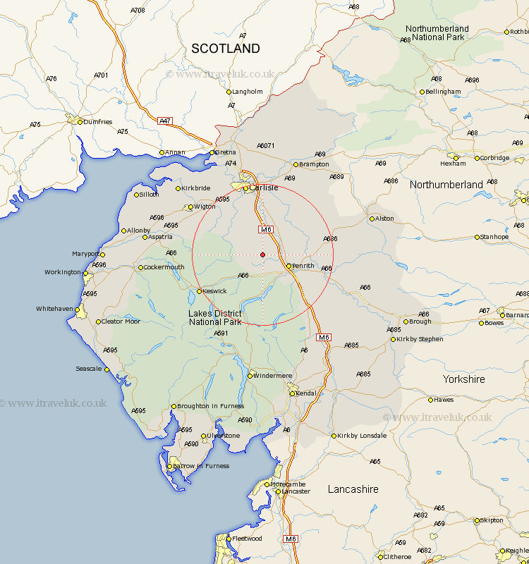
Cumbria Map Showing Location of Skelton
Population: 1059
District: Eden
Easting: 344153 Northing: 534242
Latitude: 54.7 Longitude: -2.87
 = Skelton
District: Eden
Easting: 344153 Northing: 534242
Latitude: 54.7 Longitude: -2.87
= Skelton
This Skelton map below is supplied by Google. Use the tools in the top left corner to zoom into street level or zoom out for a road map, you may also need to zoom in to see Skelton on the map. Click and drag the map to move around. If the map fails to load try and refresh your browser or zoom in or out (+ or -).
Update - it seems Google no longer allow people to use their maps for free! This Skelton map sometimes loads and sometimes gives a error. I am working on a solution.
Closest 30 Towns or Cities to Skelton (Population over 500)
Greystoke 5.56km Dacre 9.51km Hesket Newmarket 10.32km Lasonby 11.33km Lazonby 11.33km Caldbeck 12.34km Langwathby 12.99km Kirkoswald 13.02km Ainstable 14.03km Dalston 16.6km Culgaith 18.02km Wetheral 18.81km Thursby 18.92km Westward 19.46km Keswick 19.55km Koswick 19.55km Carlisle 20.83km Kirkby Thore 22.38km Stanwix 22.65km Wigton 23.45km Hayton 23.46km Shap 24.11km Long Marston 25.11km Long Marton 25.11km Irthington 26.72km Burgh by Sands 26.81km Burgh 26.81km Burgh-by-Sands 26.81km Farlam 26.81km Rockcliff 27km