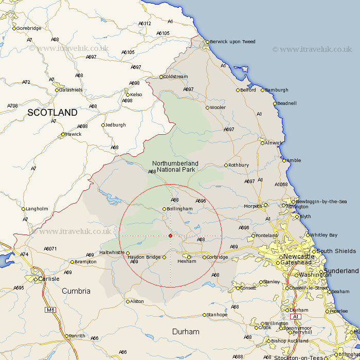
Northumberland Map Showing Location of Simonburn
Population: 205
District: Tynedale
Easting: 387223 Northing: 572859
Latitude: 55.05 Longitude: -2.2
 = Simonburn
District: Tynedale
Easting: 387223 Northing: 572859
Latitude: 55.05 Longitude: -2.2
= Simonburn
This Simonburn map below is supplied by Google. Use the tools in the top left corner to zoom into street level or zoom out for a road map, you may also need to zoom in to see Simonburn on the map. Click and drag the map to move around. If the map fails to load try and refresh your browser or zoom in or out (+ or -).
Update - it seems Google no longer allow people to use their maps for free! This Simonburn map sometimes loads and sometimes gives a error. I am working on a solution.
Closest 30 Towns or Cities to Simonburn (Population over 500)
Wark 2.14km Humshaugh 4.64km Newbrough 5.66km Chollerton 6.64km Challerton 6.64km Warden 8.55km Haydon Bridge 9.5km Acomb 9.78km Hexham 11.25km Bellingham 11.32km Sandhoe 12.1km Corbridge 14.91km Haltwhistle 16.62km Otterburn 18.66km Ridingmill 19.75km Riding 19.75km Slaley 19.78km Stamfordham 21.32km Stocksfield 22.25km Ovingham 23.19km Wylam 24.16km Prudhoe 24.94km Ponteland 28.66km Newburn 31.17km Dinnington 32.91km Woolsington 33.13km Longhorsley 34.26km Stannington 34.4km Rothbury 35.25km Morpeth 35.33km