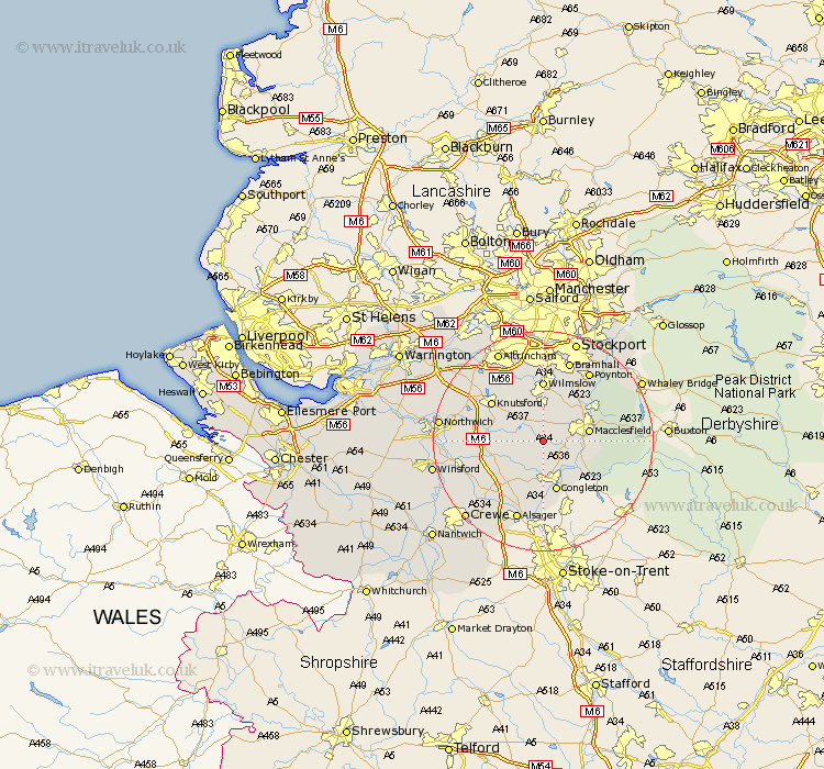
Cheshire Map Showing Location of Siddington
Population: 376
District: Macclesfield
Easting: 384427 Northing: 370752
Latitude: 53.23 Longitude: -2.23
 = Siddington
District: Macclesfield
Easting: 384427 Northing: 370752
Latitude: 53.23 Longitude: -2.23
= Siddington
This Siddington map below is supplied by Google. Use the tools in the top left corner to zoom into street level or zoom out for a road map, you may also need to zoom in to see Siddington on the map. Click and drag the map to move around. If the map fails to load try and refresh your browser or zoom in or out (+ or -).
Update - it seems Google no longer allow people to use their maps for free! This Siddington map sometimes loads and sometimes gives a error. I am working on a solution.
Closest 30 Towns or Cities to Siddington (Population over 500)
Chelford 4.33km Gawsworth 4.81km Alderley 5.56km Nether Alderley 5.56km Goostrey 6.66km Alderley Edge 7.42km Prestburg 7.85km Prestbury 7.85km Macclesfield 7.98km Peover Superior 7.98km Peover 7.98km Congleton 9.52km Holmes Chapel 9.62km Brereton 9.96km Brereton cum Smethwick 9.96km Mobberley 10.8km Wilmslow 11.12km Adlington 11.41km Knutsford 11.56km Rainow 12.4km Bollington 12.43km Plumbley 12.75km Plumley Station 12.75km Rode Heath 13.39km Sandbach 14.23km Middlewick 14.43km Middlewich 14.43km Poynton 15.12km Alsager 15.47km Bramhall 15.48km