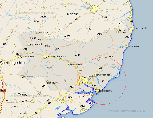
Suffolk Map Showing Location of Shottisham
Population: 179
District: Suffolk Coastal
Easting: 631953 Northing: 244517
Latitude: 52.05 Longitude: 1.38
 = Shottisham
District: Suffolk Coastal
Easting: 631953 Northing: 244517
Latitude: 52.05 Longitude: 1.38
= Shottisham
This Shottisham map below is supplied by Google. Use the tools in the top left corner to zoom into street level or zoom out for a road map, you may also need to zoom in to see Shottisham on the map. Click and drag the map to move around. If the map fails to load try and refresh your browser or zoom in or out (+ or -).
Update - it seems Google no longer allow people to use their maps for free! This Shottisham map sometimes loads and sometimes gives a error. I am working on a solution.
Closest 30 Towns or Cities to Shottisham (Population over 500)
Sutton 2.94km Hollesley 3.42km Martlesham 6.79km Martlesham Heath 7.08km Melton 7.19km Woodbridge 7.19km Kirkton 7.19km Kirton 7.19km Ufford 7.76km Rendlesham 7.76km Bucklesham 9.31km Felixstowe 9.54km Walton 10.23km Tunstall 10.32km Grundisburgh 10.67km Orford 10.9km Nacton 10.91km Wickham Market 11.18km Shotley 13km Chelmondiston 13.6km Witnesham 14.76km Wirnesham 14.76km Otley 15.12km Ipswich 15.27km Holbrook 16.58km Snape 16.83km Henley 17.58km Stutton 18.46km Aldeburgh 18.51km Claydon 18.6km