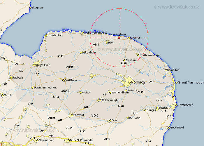
Norfolk Map Showing Location of Sheringham
Population: 7777
Area Size (ha): 313
District: North Norfolk
Easting: 615032 Northing: 342150
Latitude: 52.93 Longitude: 1.2
 = Sheringham
Area Size (ha): 313
District: North Norfolk
Easting: 615032 Northing: 342150
Latitude: 52.93 Longitude: 1.2
= Sheringham
This Sheringham map below is supplied by Google. Use the tools in the top left corner to zoom into street level or zoom out for a road map, you may also need to zoom in to see Sheringham on the map. Click and drag the map to move around. If the map fails to load try and refresh your browser or zoom in or out (+ or -).
Update - it seems Google no longer allow people to use their maps for free! This Sheringham map sometimes loads and sometimes gives a error. I am working on a solution.
Closest 30 Towns or Cities to Sheringham (Population over 500)
Weybourne 3.35km West Runton 3.35km Runton 3.35km Cromer 6.7km Holt 8.65km Roughton 8.71km Northrepps 9.68km Overstrand 10.22km Erpingham 11.61km Briston 12.88km Corpusty 13.72km Blakeney 13.9km Melton Constable 14.52km Mellon Constable 14.52km Trunch 16.3km Mundesley 16.31km Mundersley 16.31km Aylsham 17.01km Felmingham 17.31km Hindolveston 17.87km North Walsham 17.87km Cawston 18.66km Marsham 18.83km Bacton 20.15km Foulham 20.73km Foulsham 20.73km Hevingham 20.87km Reepham 21.14km Walsingham 21.95km Little Walsingham 21.95km