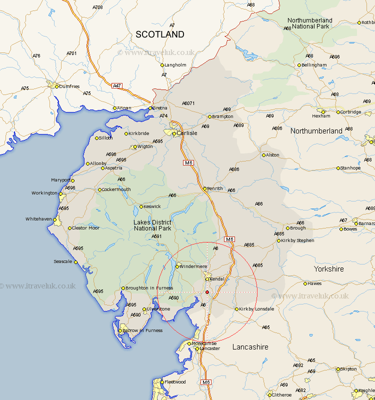
Cumbria Map Showing Location of Sedgwick
Population: 380
District: South Lakeland
Easting: 351157 Northing: 485948
Latitude: 54.27 Longitude: -2.75
 = Sedgwick
District: South Lakeland
Easting: 351157 Northing: 485948
Latitude: 54.27 Longitude: -2.75
= Sedgwick
This Sedgwick map below is supplied by Google. Use the tools in the top left corner to zoom into street level or zoom out for a road map, you may also need to zoom in to see Sedgwick on the map. Click and drag the map to move around. If the map fails to load try and refresh your browser or zoom in or out (+ or -).
Update - it seems Google no longer allow people to use their maps for free! This Sedgwick map sometimes loads and sometimes gives a error. I am working on a solution.
Closest 30 Towns or Cities to Sedgwick (Population over 500)
Natland 2.14km Levens 2.85km Heversham 3.87km Kendall 5.56km Kendal 5.56km Milnthorpe 5.67km Beetham 7.5km Holme 9.52km Arnside 10.74km Staveley 11.93km Kirkby Londsdale 13.13km Kirkby Lonsdale 13.13km Windermere 15.51km Millthrop 16.13km Sedbergh 16.13km Milnthorpe 16.13km Lower Holker 16.86km Holker 16.86km Haverthwaite 17.72km Colton 19.48km Dent 19.48km Hawkshead 19.66km Tebay 19.87km Ambleside 21.8km Conistan 23.36km Coniston 23.36km Ulverston 23.93km Ulverstone 23.93km Orton 25.21km Pennington 26.59km