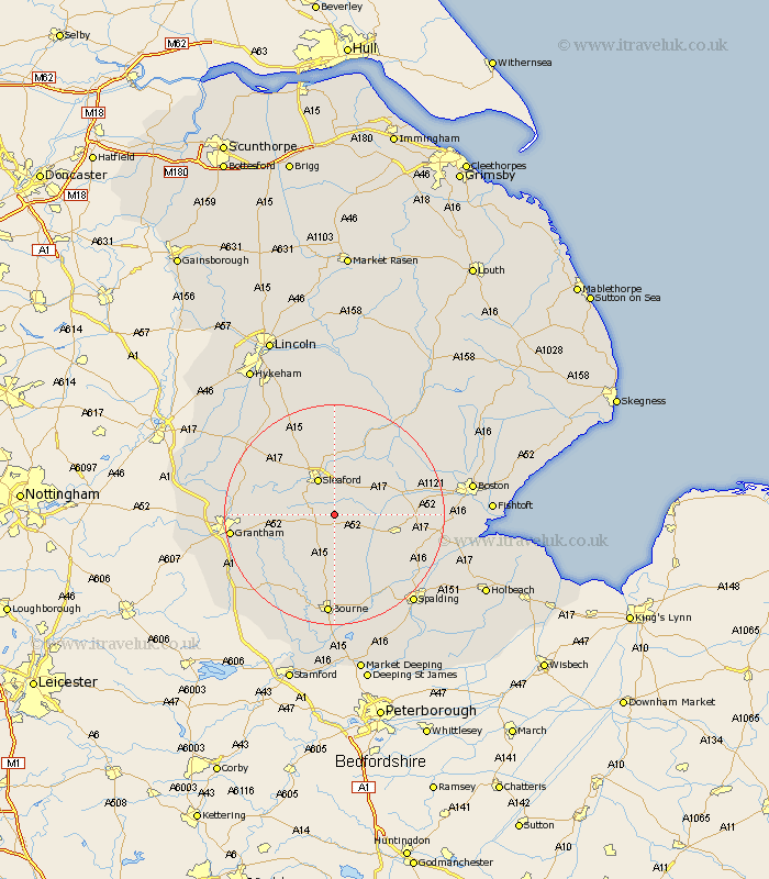
Lincolnshire Map Showing Location of Scredington
Population: 254
District: North Kesteven
Easting: 509767 Northing: 338605
Latitude: 52.93 Longitude: -0.37
 = Scredington
District: North Kesteven
Easting: 509767 Northing: 338605
Latitude: 52.93 Longitude: -0.37
= Scredington
This Scredington map below is supplied by Google. Use the tools in the top left corner to zoom into street level or zoom out for a road map, you may also need to zoom in to see Scredington on the map. Click and drag the map to move around. If the map fails to load try and refresh your browser or zoom in or out (+ or -).
Update - it seems Google no longer allow people to use their maps for free! This Scredington map sometimes loads and sometimes gives a error. I am working on a solution.
Closest 30 Towns or Cities to Scredington (Population over 500)
Helpringham 4.47km Great Hale 5.89km Hale 5.89km Billingborough 5.99km Heckington 6.71km Sleaford 7.28km Folkingham 7.73km Pointon 9.53km Leasingham 9.86km Heasingham 9.86km Buskington 11.18km Ruskington 11.18km Ropsley 11.49km Ancaster 11.77km Donington 11.77km Rippingale 12.97km Cranwell 12.98km Bicker 13.53km Brauncewell 13.72km Swineshead 14.52km Quadring 15.32km Belton 15.64km Morton 16.68km Digby 16.68km Bloxholm 17.01km Bloxholme 17.01km Gosberton 17.24km Billinghay 17.59km Corby 17.92km Caythorpe 18.17km