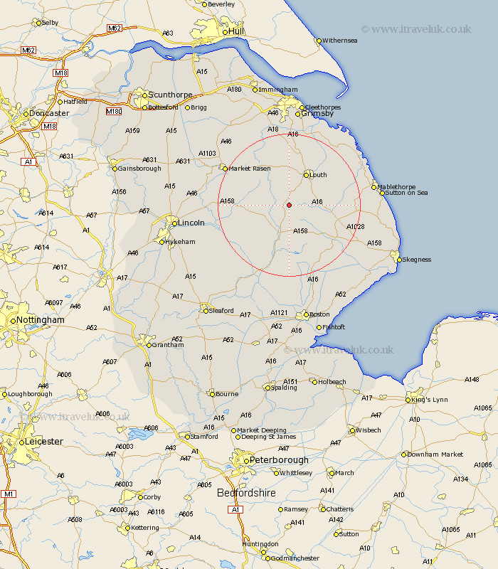
Lincolnshire Map Showing Location of Scamblesby
Population: 252
District: East Lindsey
Easting: 527765 Northing: 378002
Latitude: 53.28 Longitude: -0.08
 = Scamblesby
District: East Lindsey
Easting: 527765 Northing: 378002
Latitude: 53.28 Longitude: -0.08
= Scamblesby
This Scamblesby map below is supplied by Google. Use the tools in the top left corner to zoom into street level or zoom out for a road map, you may also need to zoom in to see Scamblesby on the map. Click and drag the map to move around. If the map fails to load try and refresh your browser or zoom in or out (+ or -).
Update - it seems Google no longer allow people to use their maps for free! This Scamblesby map sometimes loads and sometimes gives a error. I am working on a solution.
Closest 30 Towns or Cities to Scamblesby (Population over 500)
Horncastle 9.52km Banovallum 9.52km Louth 10.28km Legbourne 10.46km Mareham on the Hill 11.17km Mareham 11.17km Mareham-on-the-Hill 11.17km Wragby 14.4km Grimoldby 14.44km Manby 15.31km Spilsby 16.51km Holton 16.72km Bardney 17.2km Woodhall Spa 17.28km binbrook 17.95km Alford 18.12km Fulstow 19.06km Coningsby 19.34km Market Rasen 19.98km Willoughby 20.25km North Thoresby 20.51km North Coates 21.81km Tattershall 21.81km Middle Rasen 21.85km Saltfleetby 21.95km Saltfleetby St Clement 21.95km Saltfleetby Saint Clement 21.95km Saltfleetby St. Clement 21.95km Carrington 22.35km Tetney 22.67km