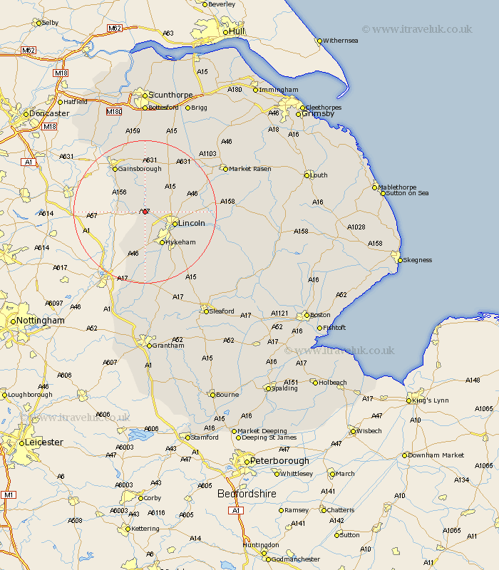
Lincolnshire Map Showing Location of Saxilby
Population: 3008
Area Size (ha): 108
District: West Lindsey
Easting: 490028 Northing: 375292
Latitude: 53.27 Longitude: -0.65
 = Saxilby
Area Size (ha): 108
District: West Lindsey
Easting: 490028 Northing: 375292
Latitude: 53.27 Longitude: -0.65
= Saxilby
This Saxilby map below is supplied by Google. Use the tools in the top left corner to zoom into street level or zoom out for a road map, you may also need to zoom in to see Saxilby on the map. Click and drag the map to move around. If the map fails to load try and refresh your browser or zoom in or out (+ or -).
Update - it seems Google no longer allow people to use their maps for free! This Saxilby map sometimes loads and sometimes gives a error. I am working on a solution.
Closest 30 Towns or Cities to Saxilby (Population over 500)
Skellingthorpe 4.33km Torksey 5.84km Scrampton 6.66km Scampton 6.66km Marton 7.85km Lincoln 8.6km Ingham 8.63km North Scarle 9.26km Thorpe on the Hill 9.34km Thorpe-on-the-Hill 9.34km Thorpe 9.34km Willingham 9.52km Eagle 9.54km Hykeham 10.28km North Hykeham 10.28km Nettleham 11.08km Welton 11.68km Dunholme 12.74km Dunholm 12.74km Lea 12.95km Aubourn 13.16km Sudbrooke 13.3km Swinderby 13.4km Washingborough 13.41km Scothern 13.43km Waddington 13.56km Heighington 14.28km Reepham 14.89km Fiskerton 14.89km Gainsborough 15.1km