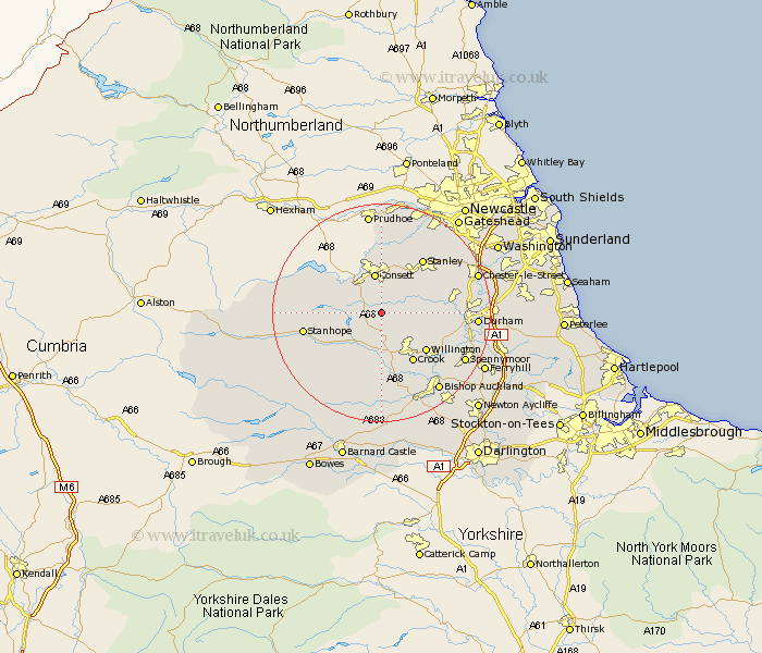
Durham Map Showing Location of Satley
Population: 292
District: Derwentside
Easting: 411789 Northing: 543181
Latitude: 54.78 Longitude: -1.82
 = Satley
District: Derwentside
Easting: 411789 Northing: 543181
Latitude: 54.78 Longitude: -1.82
= Satley
This Satley map below is supplied by Google. Use the tools in the top left corner to zoom into street level or zoom out for a road map, you may also need to zoom in to see Satley on the map. Click and drag the map to move around. If the map fails to load try and refresh your browser or zoom in or out (+ or -).
Update - it seems Google no longer allow people to use their maps for free! This Satley map sometimes loads and sometimes gives a error. I am working on a solution.
Closest 30 Towns or Cities to Satley (Population over 500)
Cornsay 3.21km Tow Law 5.56km Castleside 6.42km Lanchester 6.51km Esh 7.48km Consetti 7.49km Consett 7.49km Wolsingham 8.55km Annfield Plain 9.14km Leadgate 9.33km Langley Park 9.79km Willington 10.53km Ushaw Moor 10.69km Crook 10.7km Witton Gilbert 11.9km Stanley 12.17km Sacriston 13.35km Brandon 13.35km Stanhope 13.35km Edmondsley 13.89km Burnopfield 14.47km Etherley 15.43km High Etherley 15.43km Rowlands Gill 15.76km Durham 16.14km Pelton 16.69km Spennymoor 16.75km Coundon 16.81km West Auckland 17.52km Chester-le-Street 17.65km