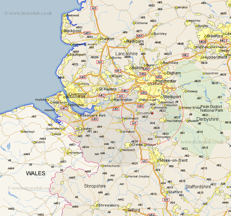
Cheshire Map Showing Location of Alderley Edge
Population: 5045
Area Size (ha): 237
District: Macclesfield
Easting: 384451 Northing: 378172
Latitude: 53.3 Longitude: -2.23
 = Alderley Edge
Area Size (ha): 237
District: Macclesfield
Easting: 384451 Northing: 378172
Latitude: 53.3 Longitude: -2.23
= Alderley Edge
This Alderley Edge map below is supplied by Google. Use the tools in the top left corner to zoom into street level or zoom out for a road map, you may also need to zoom in to see Alderley Edge on the map. Click and drag the map to move around. If the map fails to load try and refresh your browser or zoom in or out (+ or -).
Update - it seems Google no longer allow people to use their maps for free! This Alderley Edge map sometimes loads and sometimes gives a error. I am working on a solution.
Closest 30 Towns or Cities to Alderley Edge (Population over 500)
Alderley Edge 0km Alderley 1.86km Nether Alderley 1.86km Wilmslow 3.7km Chelford 4.32km Mobberley 5.84km Prestburg 5.84km Prestbury 5.84km Adlington 6.9km Bramhall 8.64km Knutsford 8.86km Poynton 9.54km Macclesfield 9.54km Peover Superior 9.54km Peover 9.54km Goostrey 9.96km Bollington 9.97km Gawsworth 10.27km Cheadle 11.17km Rainow 11.23km Bowdon 11.55km Hazel Grove 12.07km Altrincham 12.07km Stockport 12.42km Mere 12.73km Plumbley 12.74km Plumley Station 12.74km Disley 13.32km Sale 13.71km Holmes Chapel 14.23km