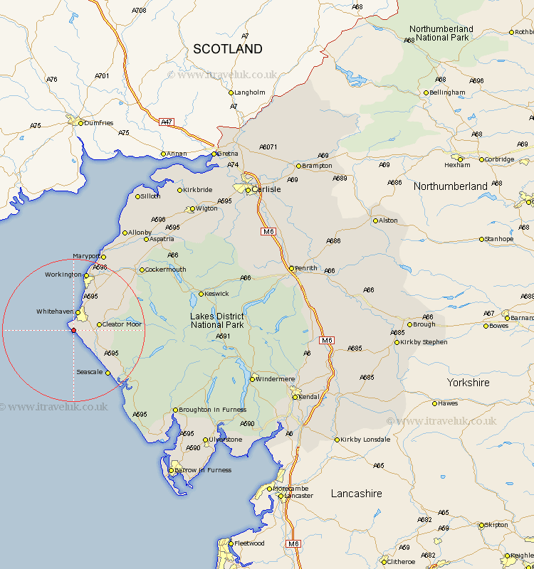
Cumbria Map Showing Location of St Bees
Population: 1777
Area Size (ha): 52
District: Copeland
Easting: 295316 Northing: 512847
Latitude: 54.5 Longitude: -3.62
 = St Bees
Area Size (ha): 52
District: Copeland
Easting: 295316 Northing: 512847
Latitude: 54.5 Longitude: -3.62
= St Bees
This St Bees map below is supplied by Google. Use the tools in the top left corner to zoom into street level or zoom out for a road map, you may also need to zoom in to see St Bees on the map. Click and drag the map to move around. If the map fails to load try and refresh your browser or zoom in or out (+ or -).
Update - it seems Google no longer allow people to use their maps for free! This St Bees map sometimes loads and sometimes gives a error. I am working on a solution.
Closest 30 Towns or Cities to St Bees (Population over 500)
Whitehaven 5.66km Cleator Moor 6.72km Egremont 7.45km Parton 7.72km Frizington 9.37km Lowca 9.51km Distington 10.71km Seascale 15.58km Lamplugh 15.83km Dean 16.23km Gosforth 16.25km Workington 16.99km Brigham 21.08km Flimby 21.38km Broughton Moor 22.56km Maryport 23.47km Dearham 25.18km Cockermouth 25.28km Bridekirk 25.98km Crosscanonby 28.5km Bootle 30.58km Aspatria 33.25km Koswick 34.11km Keswick 34.11km Conistan 38.54km Coniston 38.54km Bromfield 40.25km Millom 40.34km Hawkshead 42.55km Ambleside 43.02km