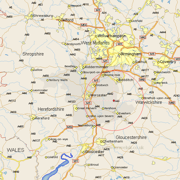
Worcestershire Map Showing Location of Rous Lench
Population: 285
District: Wychavon
Easting: 402279 Northing: 252093
Latitude: 52.17 Longitude: -1.97
 = Rous Lench
District: Wychavon
Easting: 402279 Northing: 252093
Latitude: 52.17 Longitude: -1.97
= Rous Lench
This Rous Lench map below is supplied by Google. Use the tools in the top left corner to zoom into street level or zoom out for a road map, you may also need to zoom in to see Rous Lench on the map. Click and drag the map to move around. If the map fails to load try and refresh your browser or zoom in or out (+ or -).
Update - it seems Google no longer allow people to use their maps for free! This Rous Lench map sometimes loads and sometimes gives a error. I am working on a solution.
Closest 30 Towns or Cities to Rous Lench (Population over 500)
Church Lench 2.18km Bishampton 3.41km Inkberrow 3.7km Harvington 5.04km Fladbury 6.52km Charlton 7.5km Cleeve Prior 7.77km Offenham 8.16km Pershore 8.8km Peopleton 9.28km Feckenham 9.33km South Littleton 9.35km Littleton 9.35km Astwood Bank 9.54km Cropthorne 9.55km Evesham 9.55km Crowle 10.88km Badsey 10.88km Hanbury 12.48km Pebworth 12.66km Cow Honeybourne 12.99km Honeybourne 12.99km Wadborough 13.69km Defford 13.81km Sedgeberrow 14.83km Redditch 15km Radditch 15km Ashton-under-Hill 15.01km Ashton under Hill 15.01km Eckington 15.12km