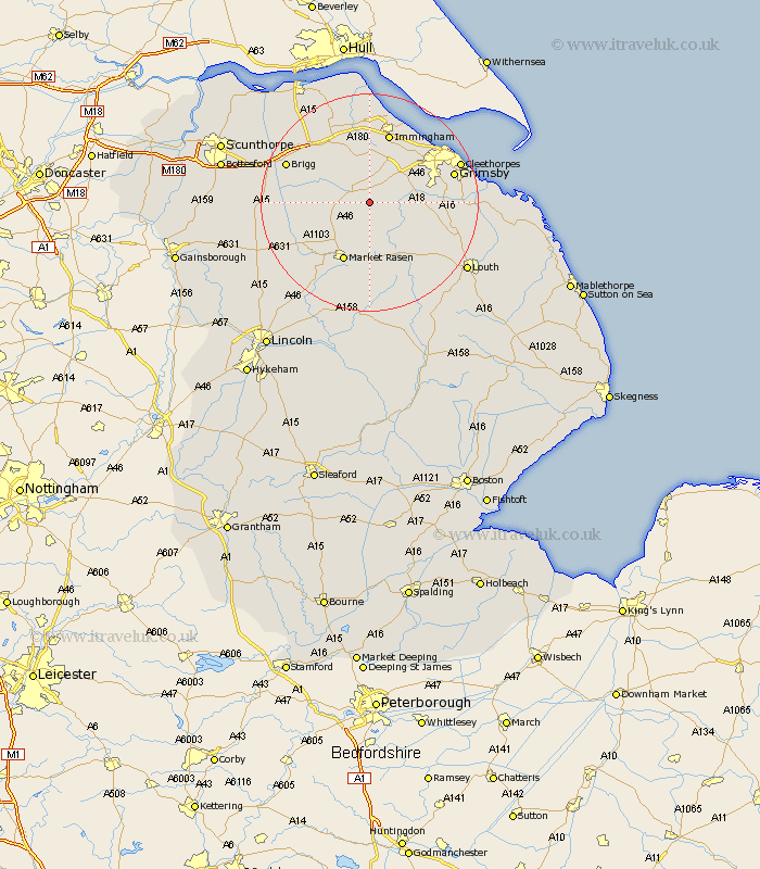
Lincolnshire Map Showing Location of Rothwell
Population: 196
District: West Lindsey
Easting: 515005 Northing: 399935
Latitude: 53.48 Longitude: -0.27
 = Rothwell
District: West Lindsey
Easting: 515005 Northing: 399935
Latitude: 53.48 Longitude: -0.27
= Rothwell
This Rothwell map below is supplied by Google. Use the tools in the top left corner to zoom into street level or zoom out for a road map, you may also need to zoom in to see Rothwell on the map. Click and drag the map to move around. If the map fails to load try and refresh your browser or zoom in or out (+ or -).
Update - it seems Google no longer allow people to use their maps for free! This Rothwell map sometimes loads and sometimes gives a error. I am working on a solution.
Closest 30 Towns or Cities to Rothwell (Population over 500)
Caistor 3.31km Nettleton 3.31km binbrook 7.83km Laceby 8.64km Keelby 9.34km South Killingholme 9.53km North Kelsey 9.93km South Kelsey 11.18km Healing 11.39km Waltham 11.63km Market Rasen 11.96km Stallingborough 12.41km Barnetby le Wold 12.79km Barnetby 12.79km Middle Rasen 12.94km Habrough 13.02km Immingham 13.39km Holton le Clay 13.74km North Thoresby 14.46km Great Coates 15.26km Grimsby 15.37km Great Grimsby 15.37km Ulceby 15.47km Brigg 16.13km Wrawby 16.15km Humberstone 16.4km Humberston 16.4km Tetney 16.54km Fulstow 16.96km Waddingham 16.96km