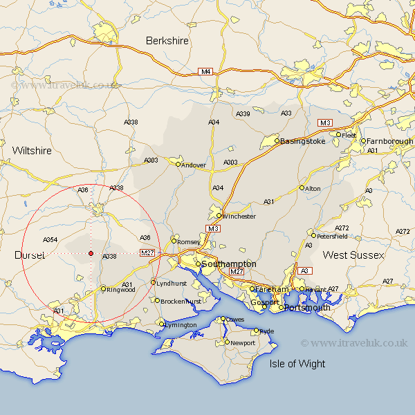
Hampshire Map Showing Location of Rockbourne
Population: 319
District: New Forest
Easting: 411706 Northing: 116803
Latitude: 50.95 Longitude: -1.83
 = Rockbourne
District: New Forest
Easting: 411706 Northing: 116803
Latitude: 50.95 Longitude: -1.83
= Rockbourne
This Rockbourne map below is supplied by Google. Use the tools in the top left corner to zoom into street level or zoom out for a road map, you may also need to zoom in to see Rockbourne on the map. Click and drag the map to move around. If the map fails to load try and refresh your browser or zoom in or out (+ or -).
Update - it seems Google no longer allow people to use their maps for free! This Rockbourne map sometimes loads and sometimes gives a error. I am working on a solution.
Closest 30 Towns or Cities to Rockbourne (Population over 500)
South Damerham 2.19km Damerham 2.19km Fordingbridge 2.98km Hale 7.01km Sandleheath 7.51km Ibsley 8.2km Ringwood 11.66km Bramshaw 15.29km Burley 17.53km West Wellow 17.61km Sherfield English 17.89km Cadnam 17.91km Minstead 17.96km Bransgore 19.82km Lyndhurst 19.83km Sopley 20.68km Romsey 23.63km Brockenhurst 23.87km Sway 24.73km Broughton 24.75km Totton 24.8km Michelmersh 25.1km Michlemersh 25.1km Eling 25.15km Over Wallop 26.11km Nether Wallop 26.29km New Milton 27.32km Milton 27.32km Hordle 27.62km Kings Somborne 27.71km